PYRTPlan Your Road Trips
Create TripCommunityMerchandise
PYRTPlan Your Road Trips
Create TripCommunityMerchandise
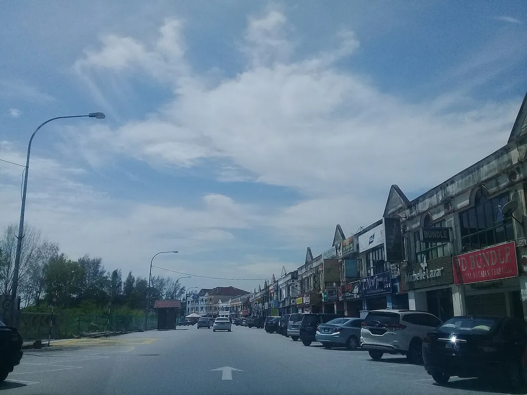
Port Dickson: Pusat bandar Port Dickson.
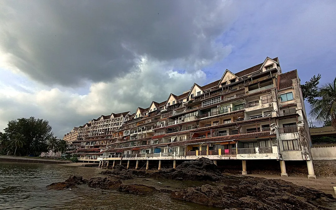
Blocks of holiday apartments at a Port Dickson suburb of Bagan Pinang. The block at the far left is a 4-star hotel, Corus Paradise Resort.
Photo by Wiki Farazi
Destinations
Home›Destinations›Bukit Kerinchi
AsiaMalaysiaKuala Lumpur

Bukit Kerinchi

Kuala Lumpur, Malaysia · Asia

About Bukit Kerinchi

Bukit Kerinchi works well as a base: 5 minutes from Kuchai Lama, 38km from Genting Highlands Road.

Bukit Kerinchi is in Kuala Lumpur, Malaysia, with about 35,000 people. You drive on the left here. The nearest town is Kuchai Lama, about 4 km away.

Where to Stay in Bukit Kerinchi

Compare prices across Booking.com, Airbnb, Expedia, and more. Select your dates to see availability.

Filter presets

Pick your must-haves once: provider links open pre-filtered. Each filter lists which sites it applies to.

Booking.comExpediaTripAdvisorHotels.comAgodaAirbnb

Compare before you book!

Prices can vary significantly between platforms. We recommend checking at least 2-3 sites to find the best deal for your stay in Bukit Kerinchi.

Explore the Area

Discover famous landmarks, scenic roads, and more near Bukit Kerinchi.

Loading map...
Open in Google Maps

Frequently Asked Questions

What is there to see near Bukit Kerinchi?

Within an hour or so of Bukit Kerinchi: KL Tower (7 km), PETRONAS Skybridge (8 km), Petronas Twin Towers (8 km), Sunway Lagoon (8 km).

Are there any good drives near Bukit Kerinchi?

The nearest famous roads are Genting Highlands and Genting Highlands Road.

Where is Bukit Kerinchi?

Bukit Kerinchi is in Kuala Lumpur, Malaysia, about 4 km from Kuchai Lama.

Road trip

Drive to Bukit Kerinchi

Add it as a stop and the planner works out the driving, the nights and what's worth seeing on the way.

Start planning

What's nearby?

Swipe through places to go

Places within a drive of Bukit Kerinchi. Keep the ones you like and add them to your trip.

Explore now

Quick Information

Population
35,000
Continent
Asia
Country
Malaysia
Region
Kuala Lumpur
Timezone
Asia/Kuala_Lumpur
Coordinates
3.1063, 101.6676

Emergency & Services

Essential numbers in Malaysia

Police
999
Ambulance
999
Fire
994
Driving side
left
Full driving guide for Malaysia

Tags

AsiaMalaysiaKuala LumpurTown

Worth the detour from Bukit Kerinchi

8 notable places within an hour's drive.

scenic viewpoint

KL Tower

A 421-meter telecommunications tower on Bukit Nanas in Kuala Lumpur offering panoramic city views and a glass sky box experience.

7 km · about 10 min drive

landmark

PETRONAS Skybridge

Double-deck skybridge connecting the Petronas Twin Towers at the 41st and 42nd floors, 170 metres above the ground.

8 km · about 15 min drive

landmark

Petronas Twin Towers

452-metre twin skyscrapers in central Kuala Lumpur with a public skybridge, observation deck and large underground car park.

8 km · about 15 min drive

landmark

Sunway Lagoon

Multi-park destination near Kuala Lumpur with a water park, amusement park, wildlife park, and extreme park.

8 km · about 15 min drive

landmark

Batu Caves

A limestone hill with massive cave temples and a 42-meter golden statue of Lord Murugan, a major Hindu pilgrimage site near Kuala Lumpur.

15 km · about 30 min drive

landmark

Putra Mosque, Putrajaya

Rose-granite mosque beside Putrajaya Lake in Malaysia's administrative capital, surrounded by wide boulevards and signature bridges.

19 km · about 20 min drive

famous road

Genting Highlands Road

Malaysia's favourite hill-climb: a smooth, relentlessly twisty ascent from Genting Sempah to the casino resort at 1,800 m, beloved by local drivers and often wrapped in cool cloud.

38 km · about 45 min drive

mountain pass

Genting Highlands

Hilltop resort town at 1,700 metres above Kuala Lumpur, reached by a steep switchback highway from Genting Sempah.

38 km · about 45 min drive

Driving roads near Bukit Kerinchi

  • Right hereKL TowerA 421-meter telecommunications tower on Bukit Nanas in Kuala Lumpur offering panoramic city views and a glass sky box experience.
  • 38 kmGenting Highlands RoadMalaysia's favourite hill-climb: a smooth, relentlessly twisty ascent from Genting Sempah to the casino resort at 1,800 m, beloved by local drivers and often wrapped in cool cloud.
  • 38 kmGenting HighlandsHilltop resort town at 1,700 metres above Kuala Lumpur, reached by a steep switchback highway from Genting Sempah.

When to drive here

Year-round

Tropical latitude: plan around the wet season rather than temperature.

Nearby Destinations

Other places to explore near Bukit Kerinchi.

Seputeh

🇲🇾 Malaysia

2 km awayPop. 18,605

Taman Desa

🇲🇾 Malaysia

2 km awayPop. 25,000

Bangsar

🇲🇾 Malaysia

3 km awayPop. 40,000

Kuchai Lama

🇲🇾 Malaysia

4 km awayPop. 50,000

Taman OUG

🇲🇾 Malaysia

4 km awayPop. 25,989

Kuala Lumpur

🇲🇾 Malaysia

4 km awayPop. 1,453,975

Taman Naga Emas

🇲🇾 Malaysia

5 km awayPop. 2,350

Sri Petaling

🇲🇾 Malaysia

5 km awayPop. 50,000

Plan a trip around Bukit Kerinchi

Asia road trip planner

Your trip starts here

Plan a road trip from Bukit Kerinchi.

Pick the days, drop in the stops, and share it with whoever's coming.

Start planning
PYRT

The ultimate road trip planning platform. Discover 150,000+ destinations worldwide, plan scenic routes, and create unforgettable adventures.

Inspiration

  • Discover Trips
  • Travel Guides
  • Community

The Product

  • Calendar Planner
  • Integrations
  • How It Works
  • Collaboration Mode
  • Get the App
  • Merchandise: PYRT Supply Co.
  • Become a Creator
  • Trip Marketplace

Plan Your Trip

  • Road Trip Planner
  • Famous Routes
  • Drive Times & Distances
  • Planners by Country
  • Best Road Trip Planner App
  • Discover Road Trips
  • Events
  • Travel Guides
  • How It Works
  • My Trips
  • Community Groups

Company

  • Terms of Service
  • Privacy Policy
  • About PYRT
  • Support
  • Contact Us
  • Sign In
  • Create Account

© 2026 Plan Your Road Trips. All rights reserved.

•[email protected]
Data sources:GeoNames (CC BY 4.0)•Wikimedia Commons (CC BY-SA)•Mapbox•Photography: George Lawrence