PYRTPlan Your Road Trips
Create TripCommunityMerchandise
PYRTPlan Your Road Trips
Create TripCommunityMerchandise
Views of Brighton and Hove #8.  This five-photo panorama looks northwards and northeastwards from the end of the Palace Pier towards East Cliff, Kemp Town, Roedean, Ovingdean and Rottingdean.  Among the many buildings and landmarks visible are (approximately from left to right, i.e. west to east) the Brighton Aquarium, Amex House, Brighton Wheel, Van Alen Building, New Steine, Brighton College, St Luke's Primary School, the Bristol Estate, Brighton Racecourse, The Lanes Hotel, Royal Crescent, the Royal Alexandra Children's Hospital (new building), the Royal Sussex County Hospital, the spires of St George's Church and the former St Mark's Church, Kemp Town, the houses of Roedean, Roedean School, Brighton Marina, Ian Fraser House (headquarters of Blind Veterans UK, formerly St Dunstan's), Rottingdean Windmill and Rottingdean village.
Views of Brighton and Hove #11.  An approximately 120° panorama of Brighton, looking almost due westwards from Tenantry Down (the triangle of land between Tenantry Down Road, Bear Road and Warren Road), near the 463-foot summit of Race Hill.  This was a bright day, but heavy cloud came in from the northwest (towards the right of the picture).  Almost the whole of Brighton is laid out in this six-picture panorama.

The city centre occupies the leftmost quarter; prominent on the skyline are Chartwell Court, Sussex Heights and the Bedford Hotel.
Next come the offices in the Queen's Road area, followed by Brighton railway station—in front of which is the toweringly tall St Bartholomew's Church.  Behind above the station are the houses of West Hill, and also just visible is the roofline of another tall Victorian church—St Michael and All Angels in the Montpelier district.
To the right (north) is the new mixed-use development of the New England Quarter, built in the early 21st century on the site of the Brighton railway works.
On the skyline beyond the carriage sheds on the Brighton Main Line (long gabled building) are the densely packed houses of Prestonville, and two of its landmark buildings: St Luke's Church and the Stanford Road School.
In front of this, and very prominent in the foreground, are the hilly, curved streets of the Round Hill district.
The large buildings in the centre of the picture are in Hollingdean: the curved industrial building is the Veolia waste transfer facility, and the tower blocks are Nettleton Lodge (left) and Dudeney Court (right), both built in 1966.  The rest of the housing on the right side of the picture is also part of the Hollingdean estate.  The more distant housing is around Preston Park and Preston Village.  Hollingbury Hill, which rises to 583 feet, is on the far right.
Some of Brighton's cemeteries and crematoria can also be seen closer to the camera.  In front of the hedge are the Brighton and Preston Cemetery (privately operated) and the Woodvale Cemetery and Crematorium (council-owned).  The spire-topped flint and brick chapel is in the Brighton and Preston Cemetery.  Just visible above the hedge is the top of the spire of the Woodvale Crematorium.  The red chimney in the centre foreground belongs to the Downs Crematorium.  All of the trees in the foreground are in the cemeteries.  The cemetery visible in the right foreground behind the flint wall is the Bear Road Cemetery.  Bear Road itself runs in front of the wall.
The area of dense terraced housing behind and to the left of the Brighton and Preston Cemetery is in the Elm Grove area.  The saddleback tower of this area's former church, St Wilfrid's, is visible in the centre towards the left.
Even further left of that is more terraced housing; this is in the Hanover area.

Camera location50° 50′ 06.97″ N, 0° 06′ 27.48″ W View this and other nearby images on: OpenStreetMap 50.835270;   -0.107632
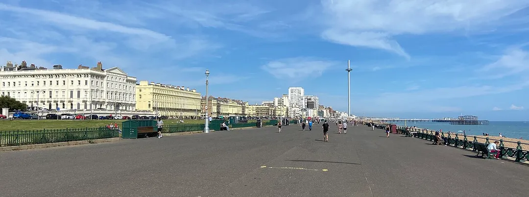
Includes the two tallest structures on the seafront
Photo by The Voice of Hassocks
Destinations
Home›Destinations›Brighton East
OceaniaAustraliaVictoria

Brighton East

Victoria, Australia · Oceania

About Brighton East

Brighton East works well as a base: 5km from Luna Park Melbourne.

Brighton East is in Victoria, Australia, with about 17,000 people. You drive on the left here.

Brighton East is a suburb in Melbourne, Victoria, Australia, 12 km south-east of Melbourne's Central Business District, located within the Cities of Bayside and Glen Eira local government areas. Brighton East recorded a population of 16,757 at the 2021 census. Brighton East lies further inland from the coast of Port

Read more Philip Bay than Brighton, its affluent, neighbouring community to the west. Its boundaries are Nepean Highway in the northwest, North Road in the north, Thomas Street in the east, Nepean Highway in the southeast, South Road in the south, and Hampton Street in the west. Whilst most of Brighton East is located within the City of Bayside, a number of properties on Thomas Street are located within the City of Glen Eira. Brighton East is known for its spacious parklands, most notably Dendy Park, one of Victoria's 10 biggest parks and outdoor recreation areas, Hurlingham Park, and Landcox Park.

Read more on Wikipedia

Where to Stay in Brighton East

Compare prices across Booking.com, Airbnb, Expedia, and more. Select your dates to see availability.

Filter presets

Pick your must-haves once: provider links open pre-filtered. Each filter lists which sites it applies to.

Booking.comExpediaTripAdvisorHotels.comAgodaAirbnb

Compare before you book!

Prices can vary significantly between platforms. We recommend checking at least 2-3 sites to find the best deal for your stay in Brighton East.

Explore the Area

Discover famous landmarks, scenic roads, and more near Brighton East.

Loading map...
Open in Google Maps

Frequently Asked Questions

What is there to see near Brighton East?

Within an hour or so of Brighton East: Luna Park Melbourne (5 km), Albert Park Circuit (7 km), SEA LIFE Melbourne Aquarium (10 km), Petrol Circus (11 km).

Where is Brighton East?

Brighton East is in Victoria, Australia.

Road trip

Drive to Brighton East

Add it as a stop and the planner works out the driving, the nights and what's worth seeing on the way.

Start planning

What's nearby?

Swipe through places to go

Places within a drive of Brighton East. Keep the ones you like and add them to your trip.

Explore now

Quick Information

Population
16,757
Continent
Oceania
Country
Australia
Region
Victoria
Timezone
Australia/Melbourne
Coordinates
-37.9023, 145.0173

Emergency & Services

Essential numbers in Australia

Police
000
Ambulance
000
Fire
000
Non-emergency police
131 444
Driving side
left

112 works from mobiles. Distances between fuel stops in the outback can exceed 200 km: plan ahead. Wildlife is most active at dawn/dusk.

Full driving guide for Australia

Tags

OceaniaAustraliaVictoriaTown

Worth the detour from Brighton East

7 notable places within an hour's drive.

landmark

Luna Park Melbourne

Historic St Kilda amusement park opened in 1912 with its iconic laughing face entrance on the waterfront.

5 km · about 10 min drive

racetrack

Albert Park Circuit

Melbourne's lakeside street circuit, traditional F1 season opener

7 km · about 15 min drive

landmark

SEA LIFE Melbourne Aquarium

Melbourne's premier aquarium on the Yarra River featuring Antarctic ice displays and an oceanarium with sharks and rays.

10 km · about 20 min drive

landmark

Petrol Circus

Melbourne's automotive culture and lifestyle brand hosting regular car meets, rides, and community events across the city.

11 km · about 20 min drive

cafe

Pellegrini's Espresso Bar

Melbourne's oldest espresso bar, opened in 1954 on Bourke Street with the city's first commercial espresso machine and an unchanged Formica bar. Order at the counter and eat standing or in the back kitchen.

11 km · about 20 min drive

landmark

Melbourne Zoo

Australia's oldest zoo established in 1862, home to over 320 animal species in the heart of Melbourne.

14 km · about 25 min drive

racetrack

Sandown Raceway

A fast, flat 3.1km circuit inside a Melbourne horse racing course, running since 1962 and one of the last surviving old-school Australian touring car venues.

14 km · about 25 min drive

Nearby Destinations

Other places to explore near Brighton East.

Caulfield South

🇦🇺 Australia

1 km awayPop. 12,328

Brighton

🇦🇺 Australia

1 km awayPop. 23,252

Ormond

🇦🇺 Australia

1 km awayPop. 8,328

McKinnon

🇦🇺 Australia

2 km awayPop. 6,878

Bentleigh

🇦🇺 Australia

2 km awayPop. 17,921

Caulfield North

🇦🇺 Australia

3 km awayPop. 16,903

Carnegie

🇦🇺 Australia

3 km awayPop. 17,909

Bentleigh East

🇦🇺 Australia

4 km awayPop. 30,159

Your trip starts here

Plan a road trip from Brighton East.

Pick the days, drop in the stops, and share it with whoever's coming.

Start planning
PYRT

The ultimate road trip planning platform. Discover 150,000+ destinations worldwide, plan scenic routes, and create unforgettable adventures.

Inspiration

  • Discover Trips
  • Travel Guides
  • Community

The Product

  • Calendar Planner
  • Integrations
  • How It Works
  • Collaboration Mode
  • Get the App
  • Merchandise: PYRT Supply Co.
  • Become a Creator
  • Trip Marketplace

Plan Your Trip

  • Road Trip Planner
  • Famous Routes
  • Drive Times & Distances
  • Planners by Country
  • Best Road Trip Planner App
  • Discover Road Trips
  • Events
  • Travel Guides
  • How It Works
  • My Trips
  • Community Groups

Company

  • Terms of Service
  • Privacy Policy
  • About PYRT
  • Support
  • Contact Us
  • Sign In
  • Create Account

© 2026 Plan Your Road Trips. All rights reserved.

•[email protected]
Data sources:GeoNames (CC BY 4.0)•Wikimedia Commons (CC BY-SA)•Mapbox•Photography: George Lawrence