Bernières-sur-Mer is worth a stop: 5 minutes from Langrune-sur-Mer, 14km from D-Day Beaches Coastal Road (D514).
Bernières-sur-Mer is in Normandy, France, with about 2,000 people. You drive on the right here. The nearest town is Langrune-sur-Mer, about 4 km away.
Bernières-sur-Mer (French pronunciation: [bɛʁnjɛʁ syʁ mɛʁ] , literally Bernières on Sea), in the arrondissement of Caen, is a commune in the Calvados department of Normandy, in northwestern France. It is part of the canton of Courseulles-sur-Mer. It lies on the English Channel coast, 3 km east of Courseulles-sur-Mer,Read more and 17 km north of Caen.
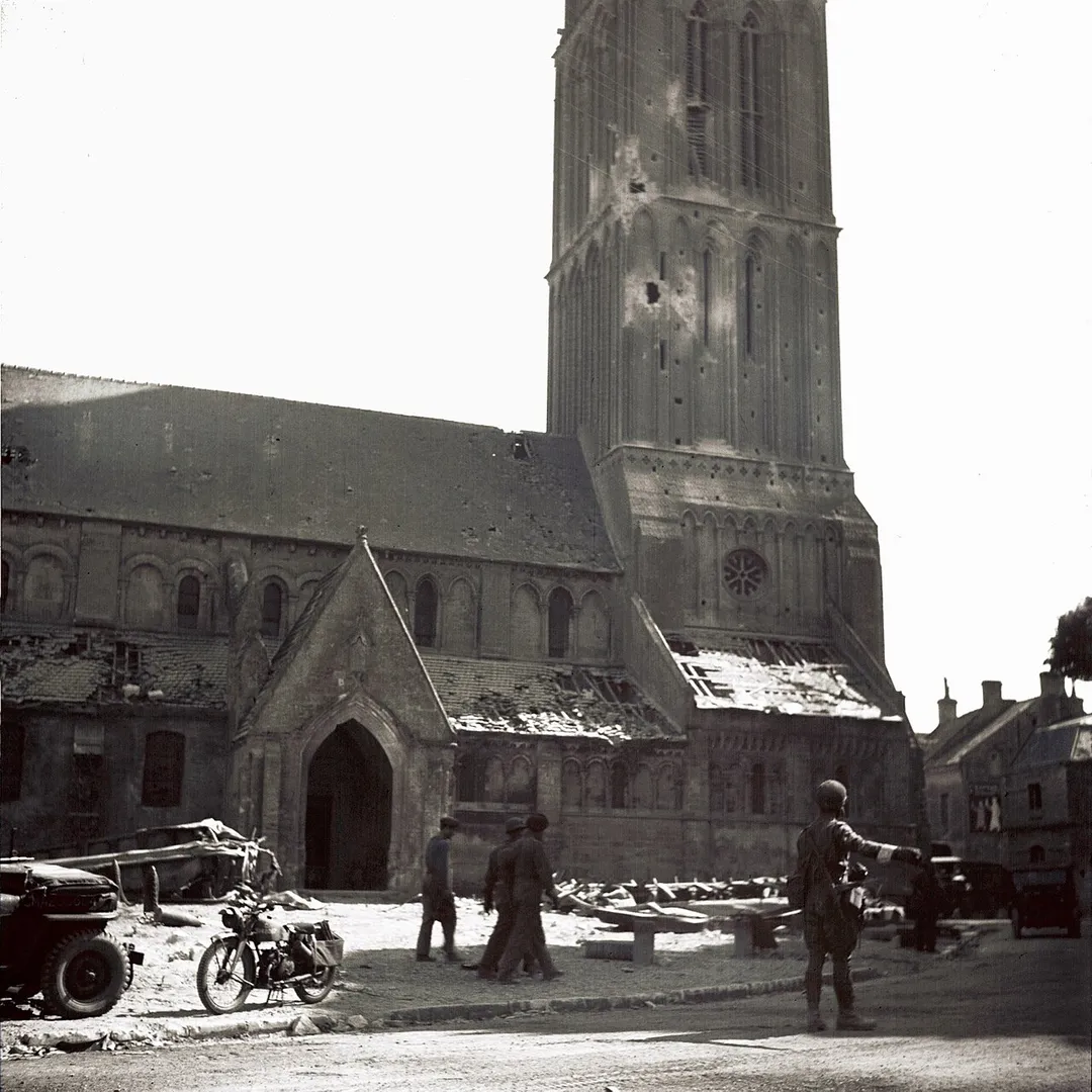
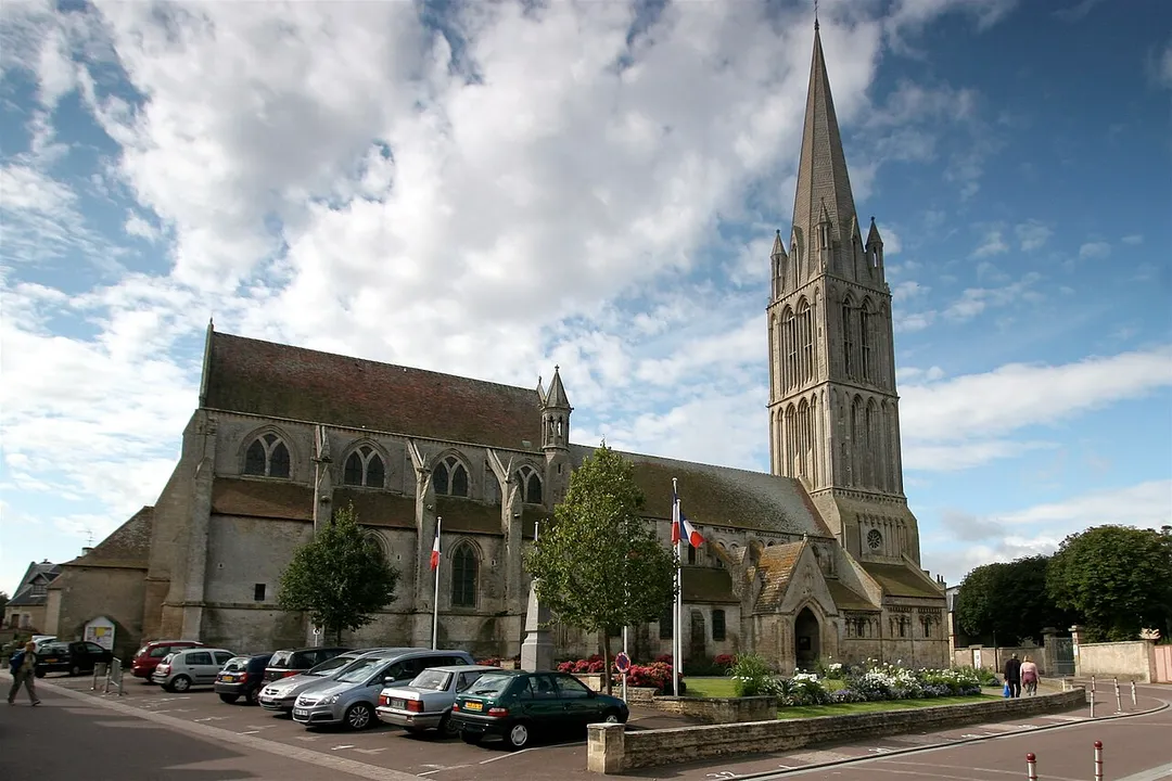
Bernières-sur-Mer is one of the oldest towns of the Côte de Nacre. Gallo-Roman traces are scattered on the territory of the municipality, and are visible in the cliffs of the "Cape Romain" east of the town. The Middle Ages saw the prosperity of Bernières - enjoying the magnificence of William the Conqueror. The Church of Bernières illustrates perfectly evolution of the region during the first half of the second millennium. In the early 20th century, served by the railway, its hotels and sandy beach, surrounded by dunes and the embankment welcomed visitors from across France.
The town was liberated by The Queen's Own Rifles of Canada on 6 June 1944 as part of the leading assault wave of D-Day Operation Overlord. Later, Le Régiment de la Chaudière, landed in reserve as part of the 8th Canadian Brigade, 3rd Canadian Division. The remains of the Atlantic Wall are still visible and are a place of remembrance where Berniérais honor each year the memory of the Canadians.
Within an hour or so of Bernières-sur-Mer: D-Day Beaches Coastal Road (D514) (14 km), Bayeux Tapestry Museum (21 km), Bayeux Cathedral (21 km), Normandy American Cemetery (31 km).
Are there any good drives near Bernières-sur-Mer?
The nearest famous roads are D-Day Beaches Coastal Road (D514) and Rouen-Les-Essarts.
Where is Bernières-sur-Mer?
Bernières-sur-Mer is in Normandy, France, about 4 km from Langrune-sur-Mer.
Road trip
Drive to Bernières-sur-Mer
Add it as a stop and the planner works out the driving, the nights and what's worth seeing on the way.
The coast road threading the five 1944 landing beaches from Utah to Sword, past Arromanches' Mulberry harbour remains, gun batteries and memorials: Normandy's essential remembrance drive.
14 km · about 25 min drive
museum
Bayeux Tapestry Museum
Home to the extraordinary 70-meter-long medieval embroidery depicting the Norman Conquest of England in 1066.
21 km · about 25 min drive
cathedral
Bayeux Cathedral
A soaring Norman-Gothic cathedral in the first town liberated in 1944, home town of the famous tapestry.
21 km · about 25 min drive
landmark
Normandy American Cemetery
Rows of white marble crosses above Omaha Beach honour the fallen of the 1944 Normandy landings.
31 km · about 35 min drive
landmark
Omaha Beach
The most fiercely contested D-Day landing beach of June 6, 1944, now a solemn memorial site overlooking the English Channel.
33 km · about 40 min drive
film location
Omaha Beach, Normandy (Saving Private Ryan's landings)
The D-Day beach whose assault opens Saving Private Ryan; the film shot in Ireland but the real site and its memorials are the destination.
33 km · about 40 min drive
beach
Deauville Beach
Glamorous Belle Époque seaside resort with parasol-dotted sands and the famous wooden boardwalk.
36 km · about 40 min drive
scenic viewpoint
Pointe du Hoc
Cratered clifftop where US Rangers scaled sheer rock under fire on D-Day, bunkers still scarring the landscape.
42 km · about 50 min drive
Driving roads near Bernières-sur-Mer
Right hereD-Day Beaches Coastal Road (D514)The coast road threading the five 1944 landing beaches from Utah to Sword, past Arromanches' Mulberry harbour remains, gun batteries and memorials: Normandy's essential remembrance drive.
42 kmPointe du HocCratered clifftop where US Rangers scaled sheer rock under fire on D-Day, bunkers still scarring the landscape.
47 kmSuisse NormandeA miniature Alps of green gorges and rocky bluffs along the River Orne, beloved by drivers and climbers.
52 kmPont de NormandieA soaring cable-stayed bridge leaping 2 km across the Seine estuary between Le Havre and Honfleur; on opening in 1995 its 856 m main span was the longest of its kind in the world.