PYRTPlan Your Road Trips
Create TripCommunityMerchandise
PYRTPlan Your Road Trips
Create TripCommunityMerchandise
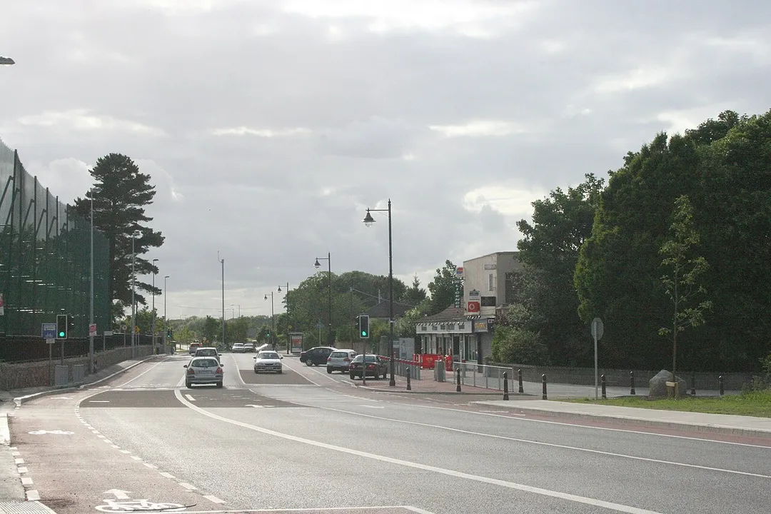
Taylor's Lane (R113), Ballyboden, Dublin.
Ballyboden Water Treatment Works Treats water from the reservoir at Bohernabreena prior to distribution to the public supply.
Ballyboden, County Dublin
Photo by Sarah777
Destinations
Home›Destinations›Ballyboden
EuropeIrelandLeinster

Ballyboden

Leinster, Ireland · Europe

About Ballyboden

Ballyboden works well as a base: 5 minutes from Tallaght, 16km from Sally Gap.

Ballyboden is in Leinster, Ireland, with about 9,600 people. You drive on the left here. The nearest town is Tallaght, about 4 km away.

Ballyboden (Irish: Baile Buadáin, meaning 'Boden Town') is a locality of Dublin, Ireland. It is within the suburb of Rathfarnham, at the foot of the Dublin Mountains between Whitechurch, Ballyroan and Knocklyon. It is in the local government area of South Dublin County Council, and is a townland in the civil parish of

Read more Rathfarnham in the barony of Uppercross. Ballyboden is home to the Ballyboden Water Treatment Plant, located on Stocking Lane. The facility is operated by Dublin City Council and Uisce Éireann. The plant itself is within the county of South Dublin.

Read more on Wikipedia

Where to Stay in Ballyboden

Compare prices across Booking.com, Airbnb, Expedia, and more. Select your dates to see availability.

Filter presets

Pick your must-haves once: provider links open pre-filtered. Each filter lists which sites it applies to.

Booking.comExpediaTripAdvisorHotels.comAgodaAirbnb

Compare before you book!

Prices can vary significantly between platforms. We recommend checking at least 2-3 sites to find the best deal for your stay in Ballyboden.

Explore the Area

Discover famous landmarks, scenic roads, and more near Ballyboden.

Loading map...
Open in Google Maps

Frequently Asked Questions

What is there to see near Ballyboden?

Within an hour or so of Ballyboden: St Patrick's Cathedral (7 km), Dublin Zoo (8 km), Sally Gap (16 km), Powerscourt Waterfall (17 km).

Are there any good drives near Ballyboden?

The nearest famous roads are Sally Gap, Wicklow Gap and Dundrod Circuit.

Where is Ballyboden?

Ballyboden is in Leinster, Ireland, about 4 km from Tallaght.

Road trip

Drive to Ballyboden

Add it as a stop and the planner works out the driving, the nights and what's worth seeing on the way.

Start planning

What's nearby?

Swipe through places to go

Places within a drive of Ballyboden. Keep the ones you like and add them to your trip.

Explore now

Quick Information

Population
9,611
Continent
Europe
Country
Ireland
Region
Leinster
Timezone
Europe/Dublin
Coordinates
53.2806, -6.3164

Emergency & Services

Essential numbers in Ireland

Police
999
Ambulance
999
Fire
999
All emergencies
112
Driving side
left
Full driving guide for Ireland

Tags

EuropeIrelandLeinsterTown

Worth the detour from Ballyboden

8 notable places within an hour's drive.

cathedral

St Patrick's Cathedral

Ireland's largest cathedral and national cathedral of the Church of Ireland, once led by Jonathan Swift.

7 km · about 15 min drive

landmark

Dublin Zoo

Ireland's largest zoo in Phoenix Park, one of the oldest zoos in Europe, home to over 400 animals.

8 km · about 15 min drive

mountain pass

Sally Gap

A high crossroads pass over the Wicklow Mountains amid blanket bog, with the famous Military Road running through.

16 km · about 30 min drive

waterfall

Powerscourt Waterfall

Ireland's highest waterfall at 121 metres, cascading down a rock face in the beautiful Powerscourt Estate in the Wicklow Mountains.

17 km · about 20 min drive

scenic viewpoint

Lough Tay (Guinness Lake)

A dark lake with a pale sand beach at one end, viewed from the R759 above; used as the Viking village in the series Vikings.

20 km · about 25 min drive

scenic viewpoint

Howth Cliff Walk

A looped cliff path around Howth Head with views to Ireland's Eye and the Wicklow mountains, easily reached from Dublin.

20 km · about 25 min drive

waterfall

Glenmacnass Waterfall

A waterfall spilling off the plateau beside the Military Road in the Wicklow Mountains, with parking right at the top.

24 km · about 30 min drive

mountain pass

Wicklow Gap

High mountain pass on the R756 across the Wicklow Mountains between Hollywood and Glendalough, following the medieval pilgrims' route of St Kevin's Road through wild granite moorland.

27 km · about 30 min drive

Driving roads near Ballyboden

  • 16 kmSally GapA high crossroads pass over the Wicklow Mountains amid blanket bog, with the famous Military Road running through.
  • 20 kmLough Tay (Guinness Lake)A dark lake with a pale sand beach at one end, viewed from the R759 above; used as the Viking village in the series Vikings.
  • 20 kmHowth Cliff WalkA looped cliff path around Howth Head with views to Ireland's Eye and the Wicklow mountains, easily reached from Dublin.
  • 27 kmWicklow GapHigh mountain pass on the R756 across the Wicklow Mountains between Hollywood and Glendalough, following the medieval pilgrims' route of St Kevin's Road through wild granite moorland.
  • 30 kmThe Spinc, GlendaloughA boardwalk ridge walk high above the Upper Lake at Glendalough, climbing beside the Poulanass waterfall.
  • 47 kmVale of AvocaA wooded river valley on the R752 in Wicklow at the meeting of the Avonmore and Avonbeg rivers.

Driving in Ireland

Drives on
the left
Petrol
~€1.78/litre
Motorway tolls
~€2.10/100km

When to drive here

April to October

Nearby Destinations

Other places to explore near Ballyboden.

Knocklyon

🇮🇪 Ireland

1 km awayPop. 14,628

Firhouse

🇮🇪 Ireland

2 km awayPop. 6,859

South Dublin

🇮🇪 Ireland

2 km awayPop. 278,749

Rathfarnham

🇮🇪 Ireland

3 km awayPop. 17,333

Oldbawn

🇮🇪 Ireland

3 km awayPop. 9,784

Tallaght

🇮🇪 Ireland

4 km awayPop. 80,339

Terenure

🇮🇪 Ireland

4 km awayPop. 7,674

Ballinteer

🇮🇪 Ireland

4 km awayPop. 8,547

Plan a trip around Ballyboden

Ireland road trip planner

Your trip starts here

Plan a road trip from Ballyboden.

Pick the days, drop in the stops, and share it with whoever's coming.

Start planning
PYRT

The ultimate road trip planning platform. Discover 150,000+ destinations worldwide, plan scenic routes, and create unforgettable adventures.

Inspiration

  • Discover Trips
  • Travel Guides
  • Community

The Product

  • Calendar Planner
  • Integrations
  • How It Works
  • Collaboration Mode
  • Get the App
  • Merchandise: PYRT Supply Co.
  • Become a Creator
  • Trip Marketplace

Plan Your Trip

  • Road Trip Planner
  • Famous Routes
  • Drive Times & Distances
  • Planners by Country
  • Best Road Trip Planner App
  • Discover Road Trips
  • Events
  • Travel Guides
  • How It Works
  • My Trips
  • Community Groups

Company

  • Terms of Service
  • Privacy Policy
  • About PYRT
  • Support
  • Contact Us
  • Sign In
  • Create Account

© 2026 Plan Your Road Trips. All rights reserved.

•[email protected]
Data sources:GeoNames (CC BY 4.0)•Wikimedia Commons (CC BY-SA)•Mapbox•Photography: George Lawrence