natural wonder
El Torcal de Antequera
A surreal karst landscape of stacked, pancake-like limestone formations carved by erosion, with ibex roaming the trails.
8 km · about 15 min drive
Andalusia, Spain · Europe
Antequera is worth a stop: 20 minutes from Villanueva de la Concepción, 8km from El Torcal de Antequera.
Antequera is in Andalusia, Spain, with about 45,000 people. You drive on the right here. The nearest town is Villanueva de la Concepción, about 10 km away.
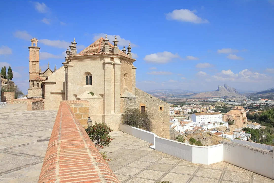
Antequera (Spanish pronunciation: [anteˈkeɾa]) is a city and municipality in the Comarca de Antequera, province of Málaga, part of the Spanish autonomous community of Andalusia. It is known as "the heart of Andalusia" (el corazón de Andalucía) because of its central location among Málaga, Granada, Córdoba, andRead more
Seville. The Antequera Dolmens Site is a UNESCO World Heritage site.
In 2011, Antequera had a population of 41,854. It covers an area of 749.34 km2 with a population density of 55.85 inhabitants/km2, and is situated at an altitude of 575 meters. There is also a very small town named "Gloriano" in the bottom of Antequera. Antequera is the most populous city in the interior of the province and the largest in area. It is the twenty-second largest in Spain. The city is located 45 km from Málaga and 115 km from Córdoba. The cities are connected by a high-speed train and the A-45 motorway. Antequera is 160 km from Seville and 102 km from Granada, which is connected by motorway A-92 and high-speed rail.
Due to its strategic position in transport and communications, with four airports located approximately one hour away and the railway running from the Port of Algeciras, Antequera is emerging as an important centre of transportation logistics, with several industrial parks, and the new Logistics Centre of Andalusia (Centro Logístico de Andalucía). In addition, the Vega de Antequera, watered by the river Guadalhorce, is a fertile agricultural area that provides cereals, olive oil, and vegetables in abundance.
The nearby natural reserve of El Torcal, famous for its unstable limestone rocks, forms one of the most important karst landscapes in Europe. It has an extensive archaeological and architectural heritage, highlighted by the dolmens of Menga, Viera, and El Romeral, and numerous churches, convents, and palaces from different periods and in different styles. Antequera played a role in the rise of Andalusian nationalism: it was the site of the drafting of the Federal Constitution of Antequera in 1883, and also of the so-called Pact of Antequera in 1978, which led to the achievement of autonomy for Andalusia. It was considered as a possible headquarters of the Andalusian government, but lost the vote in favor of Seville.
Compare prices across Booking.com, Airbnb, Expedia, and more. Select your dates to see availability.
Pick your must-haves once: provider links open pre-filtered. Each filter lists which sites it applies to.
Compare before you book!
Prices can vary significantly between platforms. We recommend checking at least 2-3 sites to find the best deal for your stay in Antequera.
Discover famous landmarks, scenic roads, and more near Antequera.
Within an hour or so of Antequera: El Torcal de Antequera (8 km), Caminito del Rey (22 km), Costa del Sol (35 km), Alcazaba de Málaga (36 km).
The nearest famous roads are A-397 San Pedro to Ronda, A-397 Ronda to San Pedro Road and Sierra Nevada road to Pico Veleta (A-395).
Antequera is in Andalusia, Spain, about 10 km from Villanueva de la Concepción.
Road trip
Add it as a stop and the planner works out the driving, the nights and what's worth seeing on the way.
Start planningSwipe through places to go
Places within a drive of Antequera. Keep the ones you like and add them to your trip.
Essential numbers in Spain
Guardia Civil (traffic police): 062. Two warning triangles required in vehicles.
Full driving guide for Spain5 notable places within an hour's drive.
natural wonder
A surreal karst landscape of stacked, pancake-like limestone formations carved by erosion, with ibex roaming the trails.
8 km · about 15 min drive
scenic viewpoint
A thrilling boardwalk pinned to sheer cliff faces above the El Chorro gorge, once called the world's most dangerous path.
22 km · about 25 min drive
beach
Spain's sun-drenched southern coastline stretching from Malaga to Gibraltar, famous for over 300 days of sunshine per year.
35 km · about 40 min drive
castle
A well-preserved Moorish hilltop citadel overlooking Málaga's port, linked to the Roman theatre at its base.
36 km · about 40 min drive
landmark
A white village where houses tuck directly beneath overhanging rock ledges, with bars built into the cliff itself.
58 km · about 65 min drive
April to October
Other places to explore near Antequera.
Your trip starts here
Pick the days, drop in the stops, and share it with whoever's coming.