PYRTPlan Your Road Trips
Create TripCommunityMerchandise
PYRTPlan Your Road Trips
Create TripCommunityMerchandise
Photo of Amora
Photo of Amora
Destinations
Home›Destinations›Amora
EuropePortugalSetúbal

Amora

Setúbal, Portugal · Europe

About Amora

Amora works well as a base: 10 minutes from Laranjeiro, 10km from Tram 28 Route, Lisbon.

Amora is in Setúbal, Portugal, with about 53,000 people. You drive on the right here. The nearest town is Laranjeiro, about 4 km away.

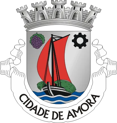
Amora is a city and civil parish in the municipality of Seixal in the district of Setúbal, Portugal. It is part of the Lisbon metropolitan area. The population in 2011 was 48,629, in an area of 24.36 km2.

Read more on Wikipedia

Where to Stay in Amora

Compare prices across Booking.com, Airbnb, Expedia, and more. Select your dates to see availability.

Filter presets

Pick your must-haves once: provider links open pre-filtered. Each filter lists which sites it applies to.

Booking.comExpediaTripAdvisorHotels.comAgodaAirbnb

Compare before you book!

Prices can vary significantly between platforms. We recommend checking at least 2-3 sites to find the best deal for your stay in Amora.

Explore the Area

Discover famous landmarks, scenic roads, and more near Amora.

Loading map...
Open in Google Maps

Frequently Asked Questions

What is there to see near Amora?

Within an hour or so of Amora: Cristo Rei (Christ the King) (7 km), Alfama District (9 km), Ponte 25 de Abril (9 km), Praça do Comércio (9 km).

Are there any good drives near Amora?

The nearest famous roads are Tram 28 Route, Lisbon, Serra da Arrábida and Estrada de Escarpa (N379-1), Serra da Arrábida.

Where is Amora?

Amora is in Setúbal, Portugal, about 4 km from Laranjeiro.

Road trip

Drive to Amora

Add it as a stop and the planner works out the driving, the nights and what's worth seeing on the way.

Start planning

What's nearby?

Swipe through places to go

Places within a drive of Amora. Keep the ones you like and add them to your trip.

Explore now

Quick Information

Population
52,577
Continent
Europe
Country
Portugal
Region
Setúbal
Timezone
Europe/Lisbon
Coordinates
38.6296, -9.1156

Emergency & Services

Essential numbers in Portugal

Police
112
Ambulance
112
Fire
112
Driving side
right
Full driving guide for Portugal

Tags

EuropePortugalSetúbalTown

Worth the detour from Amora

8 notable places within an hour's drive.

landmark

Cristo Rei (Christ the King)

78-metre monument inspired by Christ the Redeemer standing above the Tagus River estuary with arms outstretched toward Lisbon.

7 km · about 15 min drive
landmark

Alfama District

Lisbon's oldest neighborhood, a labyrinth of narrow cobbled alleys, fado music halls, and tiled facades tumbling down to the Tagus.

9 km · about 15 min drive

bridge

Ponte 25 de Abril

A red suspension bridge evoking the Golden Gate, soaring across the Tagus into southern Lisbon.

9 km · about 15 min drive

landmark

Praça do Comércio

Lisbon's grand riverside square, framed by arcades and a triumphal arch opening onto the Tagus.

9 km · about 15 min drive

castle

Castelo de São Jorge

A Moorish castle occupying a commanding hilltop overlooking the historic centre of Lisbon and the Tagus River.

10 km · about 20 min drive

famous road

Tram 28 Route, Lisbon

Lisbon's iconic vintage yellow tram rattling through the city's steepest and most atmospheric historic neighborhoods.

10 km · about 20 min drive

scenic viewpoint

Miradouro da Senhora do Monte

Lisbon's highest viewpoint, a quiet terrace surveying castle, river and rooftops at sunset.

10 km · about 20 min drive

landmark

LX Factory

A revived industrial complex of street art, design shops and cafés tucked beneath the 25 de Abril bridge.

10 km · about 20 min drive

Driving roads near Amora

  • Right herePonte 25 de AbrilA red suspension bridge evoking the Golden Gate, soaring across the Tagus into southern Lisbon.
  • Right hereTram 28 Route, LisbonLisbon's iconic vintage yellow tram rattling through the city's steepest and most atmospheric historic neighborhoods.
  • Right hereMiradouro da Senhora do MonteLisbon's highest viewpoint, a quiet terrace surveying castle, river and rooftops at sunset.
  • 16 kmPonte Vasco da GamaOne of Europe's longest bridges, an arrow-straight 12km span across the Tagus estuary.
  • 19 kmSerra da ArrábidaA coastal limestone range south of Lisbon where the N379-1 runs high above turquoise coves and beaches.
  • 20 kmEstrada Marginal (N6)A breezy coastal drive hugging the Tagus shore from Lisbon out to Estoril and Cascais.

Driving in Portugal

Drives on
the right
Petrol
~€1.78/litre
Motorway tolls
~€9.00/100km

When to drive here

April to October

Nearby Destinations

Other places to explore near Amora.

Arrentela

🇵🇹 Portugal

1 km awayPop. 30,156

Aldeia de Paio Pires

🇵🇹 Portugal

3 km awayPop. 12,179

Corroios

🇵🇹 Portugal

3 km awayPop. 52,520

Laranjeiro

🇵🇹 Portugal

4 km awayPop. 20,988

Barreiro

🇵🇹 Portugal

5 km awayPop. 51,280

Piedade

🇵🇹 Portugal

6 km awayPop. 19,472

Almada

🇵🇹 Portugal

7 km awayPop. 34,008

Pragal

🇵🇹 Portugal

7 km awayPop. 7,701

Plan a trip around Amora

Portugal road trip planner

Your trip starts here

Plan a road trip from Amora.

Pick the days, drop in the stops, and share it with whoever's coming.

Start planning
PYRT

The ultimate road trip planning platform. Discover 150,000+ destinations worldwide, plan scenic routes, and create unforgettable adventures.

Inspiration

  • Discover Trips
  • Travel Guides
  • Community

The Product

  • Calendar Planner
  • Integrations
  • How It Works
  • Collaboration Mode
  • Get the App
  • Merchandise: PYRT Supply Co.
  • Become a Creator
  • Trip Marketplace

Plan Your Trip

  • Road Trip Planner
  • Famous Routes
  • Drive Times & Distances
  • Planners by Country
  • Best Road Trip Planner App
  • Discover Road Trips
  • Events
  • Travel Guides
  • How It Works
  • My Trips
  • Community Groups

Company

  • Terms of Service
  • Privacy Policy
  • About PYRT
  • Support
  • Contact Us
  • Sign In
  • Create Account

© 2026 Plan Your Road Trips. All rights reserved.

•[email protected]
Data sources:GeoNames (CC BY 4.0)•Wikimedia Commons (CC BY-SA)•Mapbox•Photography: George Lawrence