PYRTPlan Your Road Trips
Create TripCommunityMerchandise
PYRTPlan Your Road Trips
Create TripCommunityMerchandise
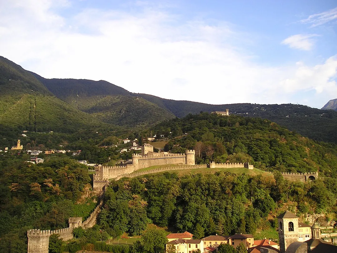
View of Montebello Castle, Bellinzona, Switzerland. The Corbaro castle can be seen in the background.
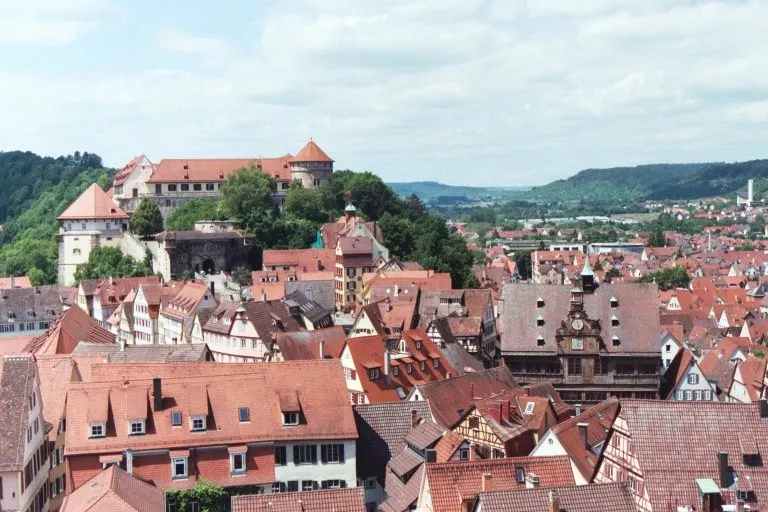
Old town of Tübingen from the top of St. Georg Stift.
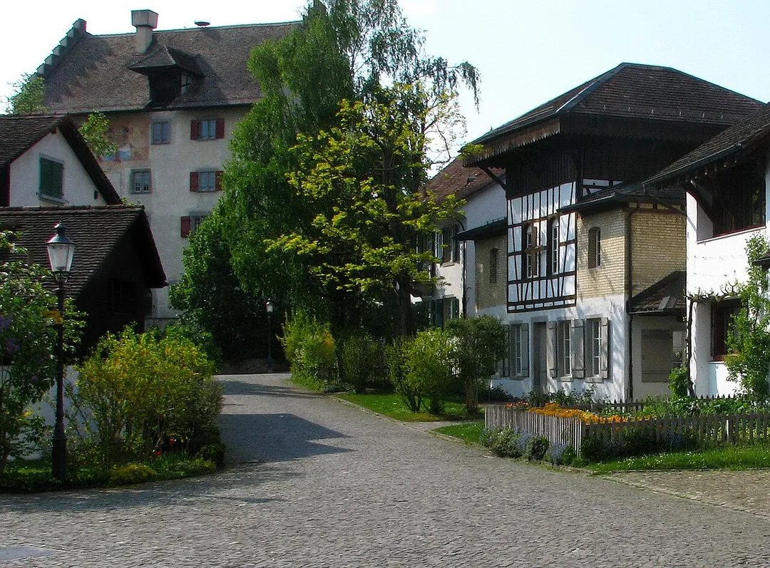
The Altstadt of Greifensee (ZH) and Greifensee castle in the background, as seen from the Gallus chapel
Photo by Massimo Macconi
Destinations
Home›Destinations›Altstadt Sud
EuropeGermanyNorth Rhine-Westphalia

Altstadt Sud

North Rhine-Westphalia, Germany · Europe

About Altstadt Sud

Altstadt Sud is worth a stop: 52km from Eifel National Park.

Altstadt Sud is in North Rhine-Westphalia, Germany, with about 28,000 people. You drive on the right here.

Where to Stay in Altstadt Sud

Compare prices across Booking.com, Airbnb, Expedia, and more. Select your dates to see availability.

Filter presets

Pick your must-haves once: provider links open pre-filtered. Each filter lists which sites it applies to.

Booking.comExpediaTripAdvisorHotels.comAgodaAirbnb

Compare before you book!

Prices can vary significantly between platforms. We recommend checking at least 2-3 sites to find the best deal for your stay in Altstadt Sud.

Explore the Area

Discover famous landmarks, scenic roads, and more near Altstadt Sud.

Loading map...
Open in Google Maps

Frequently Asked Questions

What is there to see near Altstadt Sud?

Within an hour or so of Altstadt Sud: Cologne Cathedral (Kölner Dom) (1 km), Phantasialand (16 km), Classic Remise Düsseldorf (31 km), Schloss Drachenburg (34 km).

Are there any good drives near Altstadt Sud?

The nearest famous roads are Mosel Valley Wine Route, Moselle Valley Road (B53) and Baraque de Fraiture.

Where is Altstadt Sud?

Altstadt Sud is in North Rhine-Westphalia, Germany.

Road trip

Drive to Altstadt Sud

Add it as a stop and the planner works out the driving, the nights and what's worth seeing on the way.

Start planning

What's nearby?

Swipe through places to go

Places within a drive of Altstadt Sud. Keep the ones you like and add them to your trip.

Explore now

Quick Information

Population
27,515
Continent
Europe
Country
Germany
Region
North Rhine-Westphalia
Timezone
Europe/Berlin
Coordinates
50.9333, 6.9595

Emergency & Services

Essential numbers in Germany

Police
110
Ambulance
112
Fire
112
All emergencies
112
Driving side
right

ADAC roadside assistance: +49 89 22 22 22. No general speed limit on some autobahn sections but advisory 130 km/h.

Full driving guide for Germany

Tags

EuropeGermanyNorth Rhine-WestphaliaTown

Worth the detour from Altstadt Sud

7 notable places within an hour's drive.

cathedral

Cologne Cathedral (Kölner Dom)

This twin-spired Gothic giant towers over the Rhine, its 533 steps rewarding climbers with a sweeping city panorama.

1 km · about 5 min drive

landmark

Phantasialand

Award-winning German theme park near Cologne known for incredibly detailed theming and innovative ride experiences.

16 km · about 30 min drive

landmark

Classic Remise Düsseldorf

A magnificent classic car centre in a restored locomotive roundhouse filled with rare vehicles, workshops, and automotive lifestyle shops.

31 km · about 35 min drive

castle

Schloss Drachenburg

A flamboyant 19th-century villa-castle on the Drachenfels above the Rhine, reached by Germany's oldest cogwheel railway.

34 km · about 40 min drive

scenic viewpoint

Drachenfels

A dragon-legend hilltop ruin in the Siebengebirge offers Rhine panoramas that inspired Byron and generations of romantics.

35 km · about 40 min drive

landmark

Wuppertal Schwebebahn

The world's oldest electric suspension railway glides above the Wupper River, a 1901 engineering marvel still in daily use.

38 km · about 45 min drive

national park

Eifel National Park

NRW's only national park rewires former forest with wild beech, wildcats and one of Germany's darkest star-filled skies.

52 km · about 60 min drive

Driving roads near Altstadt Sud

  • 35 kmDrachenfelsA dragon-legend hilltop ruin in the Siebengebirge offers Rhine panoramas that inspired Byron and generations of romantics.
  • 69 kmVaalserberg DrielandenpuntThe Netherlands' highest mainland point at 322.4 metres, where the Dutch, Belgian and German borders meet near Vaals.
  • 78 kmSignal de BotrangeAt 694m this is the highest point in Belgium, marked by a stone tower on the Hautes Fagnes plateau.
  • 80 kmGileppe DamA 19th-century dam near Spa crowned by a 13-ton stone lion, with a 78 m panorama tower and forested Ardennes reservoir views a short detour off the Verviers road.

Driving in Germany

Drives on
the right
Petrol
~€1.78/litre
Motorway tolls
None

When to drive here

April to October

Nearby Destinations

Other places to explore near Altstadt Sud.

Altstadt Nord

🇩🇪 Germany

1 km awayPop. 17,922

Neustadt/Nord

🇩🇪 Germany

2 km awayPop. 28,146

Bayenthal

🇩🇪 Germany

2 km awayPop. 8,714

Humboldtkolonie

🇩🇪 Germany

2 km awayPop. 15,108

Neuehrenfeld

🇩🇪 Germany

3 km awayPop. 23,621

Kalk

🇩🇪 Germany

3 km awayPop. 22,802

Nippes

🇩🇪 Germany

4 km awayPop. 113,487

Riehl

🇩🇪 Germany

4 km awayPop. 11,188

Plan a trip around Altstadt Sud

Germany road trip planner

Your trip starts here

Plan a road trip from Altstadt Sud.

Pick the days, drop in the stops, and share it with whoever's coming.

Start planning
PYRT

The ultimate road trip planning platform. Discover 150,000+ destinations worldwide, plan scenic routes, and create unforgettable adventures.

Inspiration

  • Discover Trips
  • Travel Guides
  • Community

The Product

  • Calendar Planner
  • Integrations
  • How It Works
  • Collaboration Mode
  • Get the App
  • Merchandise: PYRT Supply Co.
  • Become a Creator
  • Trip Marketplace

Plan Your Trip

  • Road Trip Planner
  • Famous Routes
  • Drive Times & Distances
  • Planners by Country
  • Best Road Trip Planner App
  • Discover Road Trips
  • Events
  • Travel Guides
  • How It Works
  • My Trips
  • Community Groups

Company

  • Terms of Service
  • Privacy Policy
  • About PYRT
  • Support
  • Contact Us
  • Sign In
  • Create Account

© 2026 Plan Your Road Trips. All rights reserved.

•[email protected]
Data sources:GeoNames (CC BY 4.0)•Wikimedia Commons (CC BY-SA)•Mapbox•Photography: George Lawrence