PYRTPlan Your Road Trips
Create TripCommunityMerchandise
PYRTPlan Your Road Trips
Create TripCommunityMerchandise
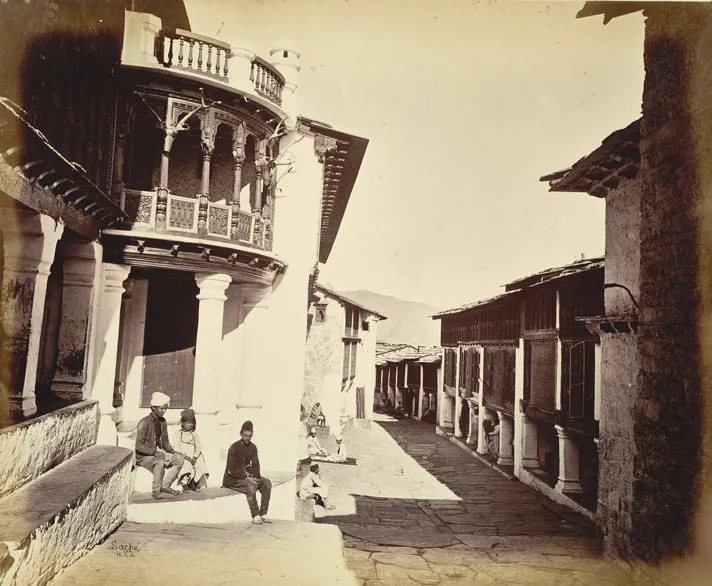
'Almora Bazaar', the main market of Almora city, Uttarakhand. c1860.
The Himalayan town of Almora
Uttarakhand (Hindi: उत्तराखण्ड, Sanskrit:उत्तराखण्डराज्यम्), formerly Uttaranchal, is a state in the northern part ofIndia. Uttarakhand is mainly known for its natural beauty of the Himalayas, the Bhabhar and the Terai. On 9 November 2000, this 27th state of the Republic of India was carved out of the Himalayan and adjoining northwestern districts of Uttar Pradesh. Two important rivers of India originate in the region, the Ganga at Gangotri and the Yamuna at Yamunotri. It is home to many holy Hindu temples and pilgrimage centres found throughout the state.
The natives of the state are generally called either Garhwali or Kumaoni depending on their place of origin. According to the 2011 census of India, Uttarakhand has a population of about 10 million.

Nature scenes, town, cities of India
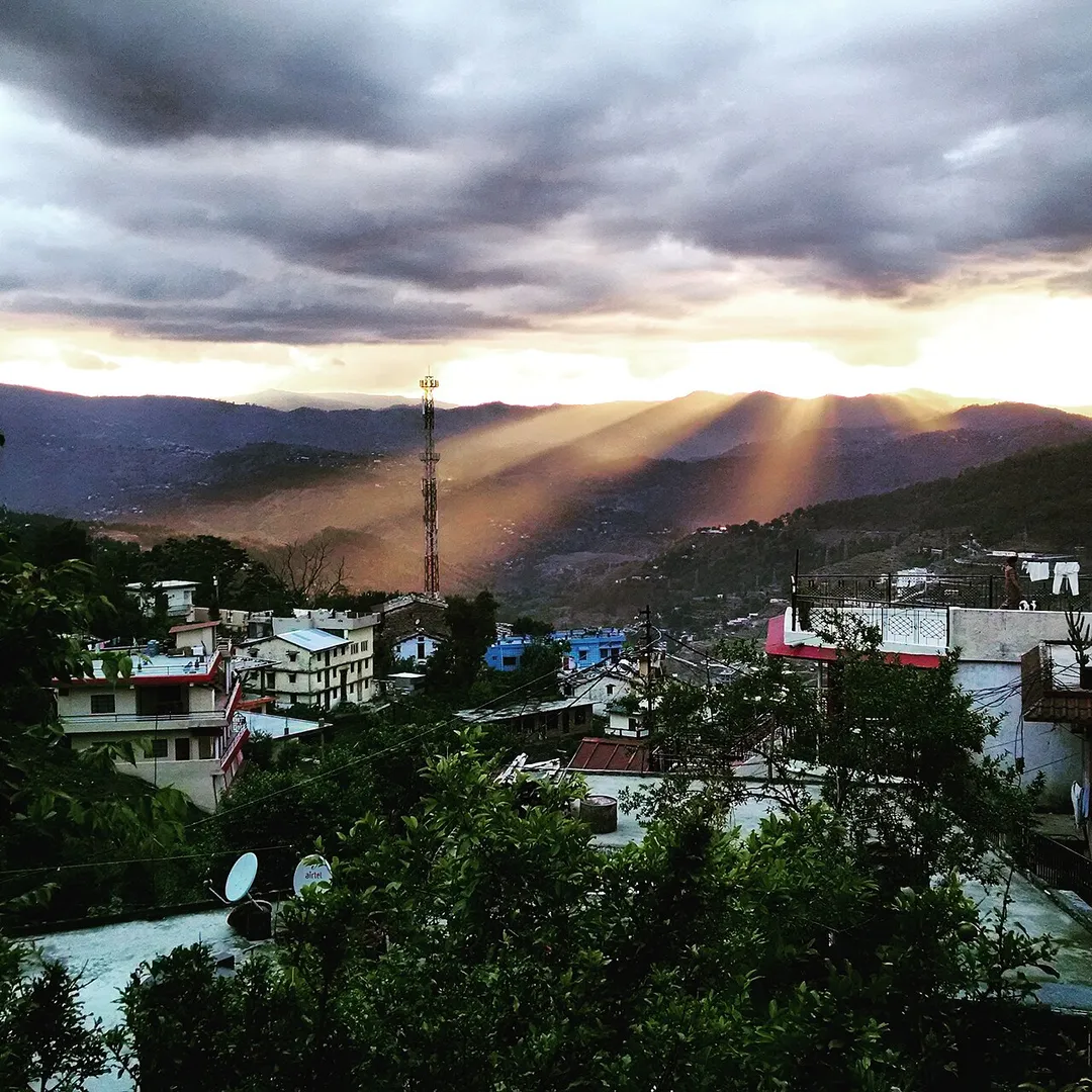
View of almora city after rainfall. The sunlight is penetrating the black clouds
Photo by John Edward Saché
Destinations
Home›Destinations›Almora
AsiaIndiaUttarakhand

Almora

Uttarakhand, India · Asia

About Almora

Almora is worth a stop: 25 minutes from Rānikhet, 30km from Nainital.

Almora is in Uttarakhand, India, with about 32,000 people. You drive on the left here. The nearest town is Rānikhet, about 22 km away.

Almora (Kumaoni: Almāḍ) is a municipal corporation and a cantonment town in the state of Uttarakhand, India. It is the administrative headquarters of Almora district. Almora is located on a ridge at the southern edge of the Kumaon Hills of the Himalaya range. The Koshi (Kaushiki) and Suyal (Salmale) rivers flow along

Read more the city and snow-capped Himalayas can be seen in the background. Almora was founded in 1568. by King Kalyan Chand; however, there are accounts of human settlements in the hills and surrounding region in the Hindu epic Mahabharata (8th and 9th century BCE). Almora was the seat of Chand kings that ruled over the Kumaon Kingdom. It is considered the cultural heart of the Kumaon region of Uttarakhand. According to the provisional results of the 2011 Census of India, Almora had a population of about 179,000. Nestled within higher peaks of the Himalaya, Almora enjoys a year-round mild temperate climate. There are 11 blocks in Almora district.

Read more on Wikipedia

Where to Stay in Almora

Compare prices across Booking.com, Airbnb, Expedia, and more. Select your dates to see availability.

Filter presets

Pick your must-haves once: provider links open pre-filtered. Each filter lists which sites it applies to.

Booking.comExpediaTripAdvisorHotels.comAgodaAirbnb

Compare before you book!

Prices can vary significantly between platforms. We recommend checking at least 2-3 sites to find the best deal for your stay in Almora.

Explore the Area

Discover famous landmarks, scenic roads, and more near Almora.

Loading map...
Open in Google Maps

Frequently Asked Questions

What is there to see near Almora?

Within an hour or so of Almora: Nainital (30 km).

Where is Almora?

Almora is in Uttarakhand, India, about 22 km from Rānikhet.

Road trip

Drive to Almora

Add it as a stop and the planner works out the driving, the nights and what's worth seeing on the way.

Start planning

What's nearby?

Swipe through places to go

Places within a drive of Almora. Keep the ones you like and add them to your trip.

Explore now

Quick Information

Population
32,442
Continent
Asia
Country
India
Region
Uttarakhand
Timezone
Asia/Kolkata
Coordinates
29.5971, 79.6591

Emergency & Services

Essential numbers in India

Police
100
Ambulance
102
Fire
101
All emergencies
112
Driving side
left
Full driving guide for India

Tags

AsiaIndiaUttarakhandTown

Worth the detour from Almora

1 notable place within an hour's drive.

scenic viewpoint

Nainital

A charming hill station built around a pear-shaped lake in the Kumaon Hills, known as the Lake District of India.

30 km · about 35 min drive

Driving roads near Almora

  • 30 kmNainitalA charming hill station built around a pear-shaped lake in the Kumaon Hills, known as the Lake District of India.

Nearby Destinations

Other places to explore near Almora.

Bāgeshwar

🇮🇳 India

29 km awayPop. 8,708

Haldwani

🇮🇳 India

44 km awayPop. 139,497

Rudrapur

🇮🇳 India

73 km awayPop. 154,554

Kashipur

🇮🇳 India

80 km awayPop. 103,138

Baheri

🇮🇳 India

93 km awayPop. 63,953

Kemrī

🇮🇳 India

98 km awayPop. 26,726

Richha

🇮🇳 India

101 km awayPop. 19,459

Plan a trip around Almora

Asia road trip planner

Your trip starts here

Plan a road trip from Almora.

Pick the days, drop in the stops, and share it with whoever's coming.

Start planning
PYRT

The ultimate road trip planning platform. Discover 150,000+ destinations worldwide, plan scenic routes, and create unforgettable adventures.

Inspiration

  • Discover Trips
  • Travel Guides
  • Community

The Product

  • Calendar Planner
  • Integrations
  • How It Works
  • Collaboration Mode
  • Get the App
  • Merchandise: PYRT Supply Co.
  • Become a Creator
  • Trip Marketplace

Plan Your Trip

  • Road Trip Planner
  • Famous Routes
  • Drive Times & Distances
  • Planners by Country
  • Best Road Trip Planner App
  • Discover Road Trips
  • Events
  • Travel Guides
  • How It Works
  • My Trips
  • Community Groups

Company

  • Terms of Service
  • Privacy Policy
  • About PYRT
  • Support
  • Contact Us
  • Sign In
  • Create Account

© 2026 Plan Your Road Trips. All rights reserved.

•[email protected]
Data sources:GeoNames (CC BY 4.0)•Wikimedia Commons (CC BY-SA)•Mapbox•Photography: George Lawrence