PYRTPlan Your Road Trips
Create TripCommunityMerchandise
PYRTPlan Your Road Trips
Create TripCommunityMerchandise
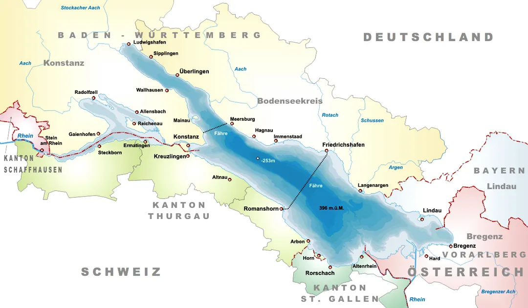
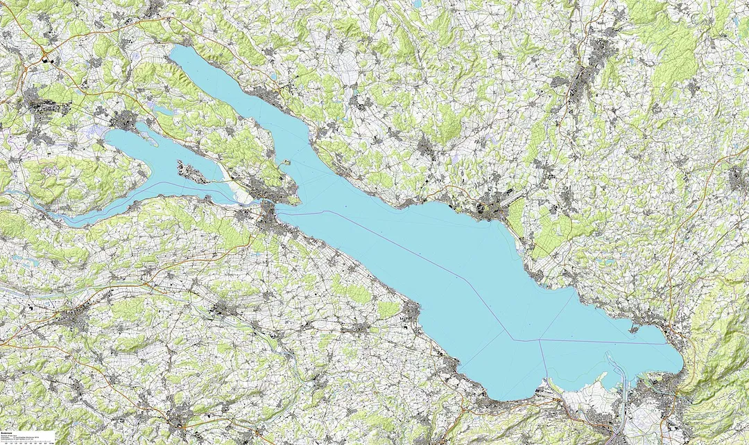
Map of the Lake Constance
General Guillaume Henri Dufour
auf der Basis von
Kartendaten:
© OpenStreetMap-Mitwirkende, SRTM; www.openstreetmap.org/copyright
Kartendarstellung:

© OpenTopoMap (CC – BY – SA)
Photo by Tschubby
Destinations
Home›Destinations›Allmannsdorf
EuropeGermanyBaden-Wurttemberg

Allmannsdorf

Baden-Wurttemberg, Germany · Europe

About Allmannsdorf

Allmannsdorf works well as a base: 5 minutes from Fürstenberg, 5km from Meersburg Castle.

Allmannsdorf is in Baden-Wurttemberg, Germany, with about 5,300 people. You drive on the right here. The nearest town is Fürstenberg, about 4 km away.

Where to Stay in Allmannsdorf

Compare prices across Booking.com, Airbnb, Expedia, and more. Select your dates to see availability.

Filter presets

Pick your must-haves once: provider links open pre-filtered. Each filter lists which sites it applies to.

Booking.comExpediaTripAdvisorHotels.comAgodaAirbnb

Compare before you book!

Prices can vary significantly between platforms. We recommend checking at least 2-3 sites to find the best deal for your stay in Allmannsdorf.

Explore the Area

Discover famous landmarks, scenic roads, and more near Allmannsdorf.

Loading map...
Open in Google Maps

Frequently Asked Questions

What is there to see near Allmannsdorf?

Within an hour or so of Allmannsdorf: Mainau Island (3 km), Meersburg Castle (5 km), Autobau Erlebniswelt (19 km), Zeppelin Museum Friedrichshafen (21 km).

Are there any good drives near Allmannsdorf?

The nearest famous roads are Schwägalp Pass, Furkajoch and Sattelegg Pass.

Where is Allmannsdorf?

Allmannsdorf is in Baden-Wurttemberg, Germany, about 4 km from Fürstenberg.

Road trip

Drive to Allmannsdorf

Add it as a stop and the planner works out the driving, the nights and what's worth seeing on the way.

Start planning

What's nearby?

Swipe through places to go

Places within a drive of Allmannsdorf. Keep the ones you like and add them to your trip.

Explore now

Quick Information

Population
5,348
Continent
Europe
Country
Germany
Region
Baden-Wurttemberg
Timezone
Europe/Berlin
Coordinates
47.6803, 9.2036

Emergency & Services

Essential numbers in Germany

Police
110
Ambulance
112
Fire
112
All emergencies
112
Driving side
right

ADAC roadside assistance: +49 89 22 22 22. No general speed limit on some autobahn sections but advisory 130 km/h.

Full driving guide for Germany

Tags

EuropeGermanyBaden-WurttembergTown

Worth the detour from Allmannsdorf

8 notable places within an hour's drive.

landmark

Mainau Island

A Mediterranean flower island on Lake Constance bursts with palms, butterfly house and a baroque palace garden.

3 km · about 5 min drive

castle

Meersburg Castle

Germany's oldest inhabited castle overlooks Lake Constance from a vineyard terrace in a charming medieval old town.

5 km · about 10 min drive

museum

Autobau Erlebniswelt

Racing driver Fredy Lienhard's supercar and motorsport collection in a former Romanshorn industrial plant on Lake Constance: Ferraris, Le Mans prototypes and Indy cars.

19 km · about 20 min drive

museum

Zeppelin Museum Friedrichshafen

The world's largest airship collection, in the Bauhaus harbour station of the town where the giants were built, including a walk-through, full-scale reconstruction of the Hindenburg's passenger quarters.

21 km · about 25 min drive

landmark

Appenzell

A colourful village in rolling green hills known for its painted wooden houses, direct democracy traditions, and the dramatic Alpstein range.

42 km · about 50 min drive

waterfall

Rhine Falls

Europe's largest plain waterfall, spanning 150 meters wide and 23 meters high near the town of Schaffhausen.

44 km · about 50 min drive

restaurant

Berggasthaus Aescher

An 1846 guesthouse pressed under a 100 m overhanging cliff below Ebenalp, made world-famous by a National Geographic cover; cable car from Wasserauen, then a 15-minute walk to rösti on the terrace.

47 km · about 55 min drive

mountain pass

Schwägalp Pass

The road under the north face of the Säntis, ending at the cable car station. Green alpine pasture country rather than high rock.

48 km · about 55 min drive

Driving roads near Allmannsdorf

11 named roads, passes and coastal drives within 100km.

  • 48 kmSchwägalp PassThe road under the north face of the Säntis, ending at the cable car station. Green alpine pasture country rather than high rock.
  • 66 kmFurkajochA narrow, quiet Vorarlberg pass with a fine view over the Rhine valley, closed through the winter.
  • 67 kmSattelegg PassA low, year-round pass between the Sihl valley and Einsiedeln, a useful and pretty link rather than a challenge.
  • 68 kmTriesenbergWalser mountain village terraced 400 m above the Rhine on the hairpin road to Malbun; its balcony viewpoints take in the entire principality and the Swiss Alpstein across the valley.
  • 78 kmRiedberg PassGermany's highest paved mountain pass at 1,407 m, carrying the B308 Alpine road over gradients up to 16% between Balderschwang and the Illertal in the Allgaeu Alps.

Driving in Germany

Drives on
the right
Petrol
~€1.78/litre
Motorway tolls
None

When to drive here

April to October

Nearby Destinations

Other places to explore near Allmannsdorf.

Staad

🇩🇪 Germany

0 km awayPop. 1,779

Petershausen-West

🇩🇪 Germany

2 km awayPop. 16,021

Konstanz

🇩🇪 Germany

3 km awayPop. 81,275

Altstadt

🇩🇪 Germany

3 km awayPop. 12,138

Paradies

🇩🇪 Germany

3 km awayPop. 6,097

Kreuzlingen

🇨🇭 Switzerland

4 km awayPop. 21,997

Litzelstetten

🇩🇪 Germany

4 km awayPop. 3,861

Wollmatingen

🇩🇪 Germany

5 km awayPop. 6,775

Plan a trip around Allmannsdorf

Germany road trip planner

Your trip starts here

Plan a road trip from Allmannsdorf.

Pick the days, drop in the stops, and share it with whoever's coming.

Start planning
PYRT

The ultimate road trip planning platform. Discover 150,000+ destinations worldwide, plan scenic routes, and create unforgettable adventures.

Inspiration

  • Discover Trips
  • Travel Guides
  • Community

The Product

  • Calendar Planner
  • Integrations
  • How It Works
  • Collaboration Mode
  • Get the App
  • Merchandise: PYRT Supply Co.
  • Become a Creator
  • Trip Marketplace

Plan Your Trip

  • Road Trip Planner
  • Famous Routes
  • Drive Times & Distances
  • Planners by Country
  • Best Road Trip Planner App
  • Discover Road Trips
  • Events
  • Travel Guides
  • How It Works
  • My Trips
  • Community Groups

Company

  • Terms of Service
  • Privacy Policy
  • About PYRT
  • Support
  • Contact Us
  • Sign In
  • Create Account

© 2026 Plan Your Road Trips. All rights reserved.

•[email protected]
Data sources:GeoNames (CC BY 4.0)•Wikimedia Commons (CC BY-SA)•Mapbox•Photography: George Lawrence