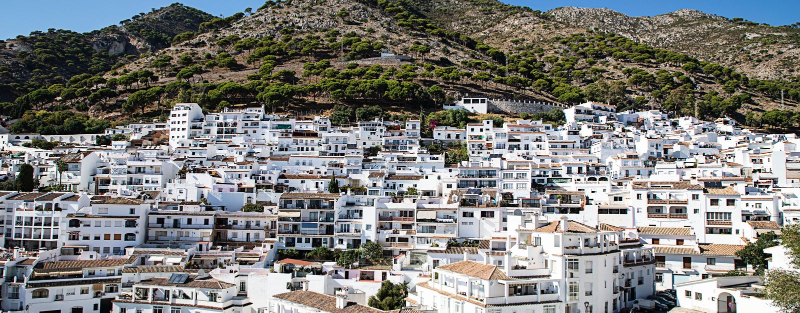
Algatocín works well as a base: 10 minutes from Genalguacil, 17km from A-397 Ronda to San Pedro Road.
Algatocín is in Andalusia, Spain, with about 934 people. You drive on the right here. The nearest town is Genalguacil, about 5 km away.
Algatocín is a town and municipality in the province of Málaga, part of the autonomous community of Andalusia in southern Spain. The municipality is situated approximately 143 kilometres (89 mi) from Málaga and 30 kilometres (19 mi) from Ronda. It is located in the west of the province in the Valle del Genal, beingRead more one of the towns that make up the comarca of the Serrania de Ronda. It is situated at an altitude of 725 metres (2,379 ft). The town has a population of approximately 900 residents, over a surface area of 20 square kilometres (7.7 sq mi), for a population density of 47 inhabitants per square kilometre (120/sq mi).
Within an hour or so of Algatocín: Júzcar (11 km), A-397 Ronda to San Pedro Road (17 km), A-397 San Pedro to Ronda (18 km), Ronda Puente Nuevo Viewpoint (21 km).
Are there any good drives near Algatocín?
The nearest famous roads are A-397 Ronda to San Pedro Road and A-397 San Pedro to Ronda.
Where is Algatocín?
Algatocín is in Andalusia, Spain, about 5 km from Genalguacil.
Road trip
Drive to Algatocín
Add it as a stop and the planner works out the driving, the nights and what's worth seeing on the way.
Serranía de Ronda village painted entirely Smurf-blue for a 2011 film premiere: the residents voted to keep it, and the lone blue pueblo glows against the white villages around it. Reached by a twisting mountain road from Ronda.
11 km · about 20 min drive
famous road
A-397 Ronda to San Pedro Road
A sweeping mountain road climbing from the coast at San Pedro over the Serranía de Ronda, all long curves and cork-oak hills.
17 km · about 20 min drive
famous road
A-397 San Pedro to Ronda
A smooth, empty mountain road climbing from the Costa del Sol into the Serrania de Ronda, all long radius curves.
18 km · about 20 min drive
scenic viewpoint
Ronda Puente Nuevo Viewpoint
The 18th-century bridge spanning the 120-metre-deep El Tajo gorge, splitting the town of Ronda in two with dizzying views into the abyss.
21 km · about 25 min drive
landmark
Ronda & Puente Nuevo
A breathtaking Andalusian hilltop town bisected by the El Tajo gorge, spanned by the dramatic 18th-century New Bridge.
22 km · about 25 min drive
landmark
White Villages of Andalusia
A stunning string of whitewashed hilltop villages scattered across the mountain landscapes between Ronda and the coast.
22 km · about 25 min drive
national park
Sierra de Grazalema Natural Park
A green limestone wilderness of gorges and Spanish-fir forests linking the white villages of Cádiz province.
22 km · about 25 min drive
scenic viewpoint
Puerto de las Palomas, Grazalema
The 1,357 m 'Pass of the Doves' on the hairpinned CA-9104 between Zahara de la Sierra and Grazalema: the signature drive of Andalusia's white villages, with griffon vultures overhead.
25 km · about 30 min drive
Driving roads near Algatocín
17 kmA-397 Ronda to San Pedro RoadA sweeping mountain road climbing from the coast at San Pedro over the Serranía de Ronda, all long curves and cork-oak hills.
18 kmA-397 San Pedro to RondaA smooth, empty mountain road climbing from the Costa del Sol into the Serrania de Ronda, all long radius curves.
21 kmRonda Puente Nuevo ViewpointThe 18th-century bridge spanning the 120-metre-deep El Tajo gorge, splitting the town of Ronda in two with dizzying views into the abyss.
25 kmPuerto de las Palomas, GrazalemaThe 1,357 m 'Pass of the Doves' on the hairpinned CA-9104 between Zahara de la Sierra and Grazalema: the signature drive of Andalusia's white villages, with griffon vultures overhead.
51 kmArcos de la FronteraA dramatic white town balanced on a narrow limestone ridge with sheer drops on three sides above the Guadalete River.
59 kmCaminito del ReyA thrilling boardwalk pinned to sheer cliff faces above the El Chorro gorge, once called the world's most dangerous path.