PYRTPlan Your Road Trips
Create TripCommunityMerchandise
PYRTPlan Your Road Trips
Create TripCommunityMerchandise
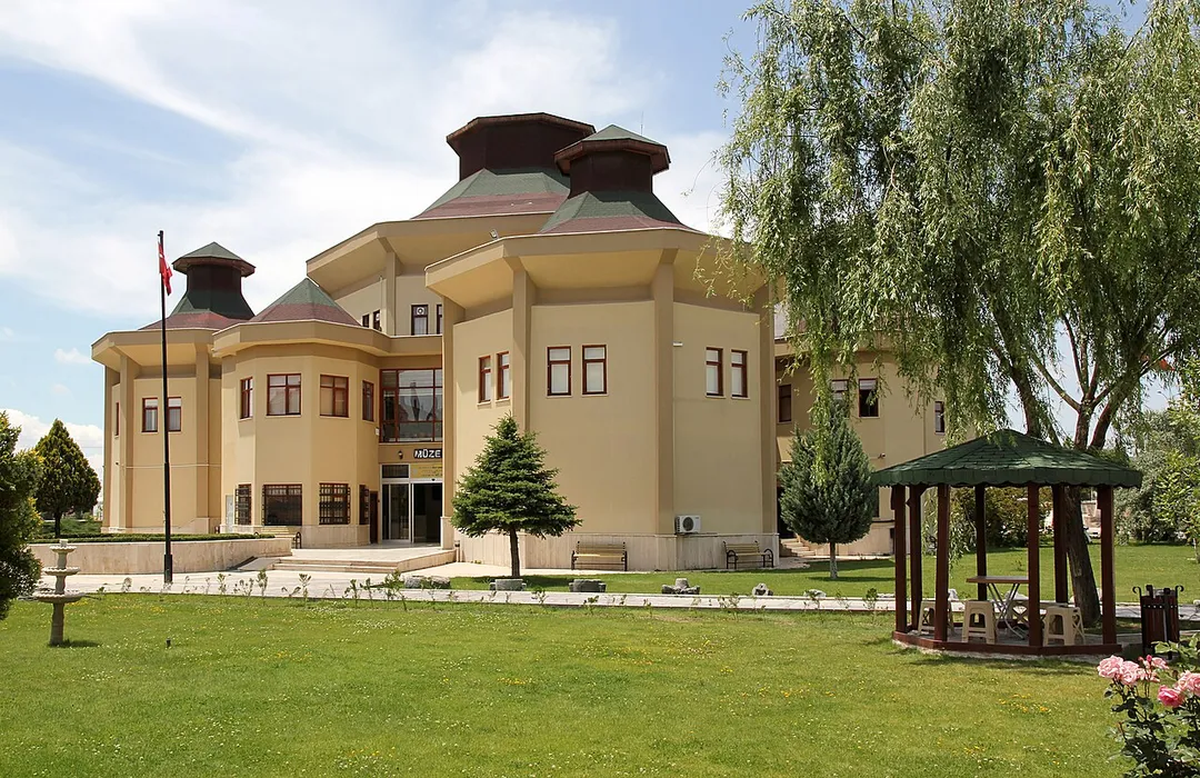
Aksaray Museum, Türkei
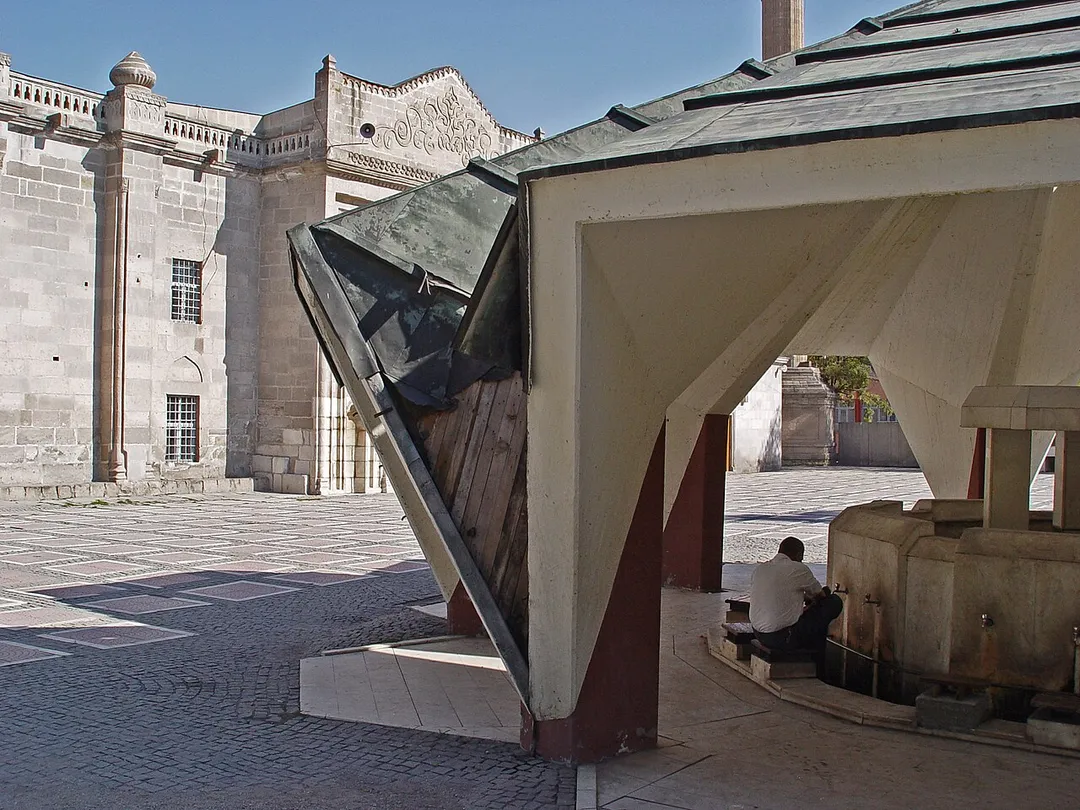
Ulu Cami stands for Great Mosque. A notice indicates this was built in the 12th century during the reign of the Seljuk sultans Mesud I and Kiliçarslan II. In the 15th century it was built anew by the Karamanoĝlu Mehmed Bey. During Ottoman times and during the republic repairs were executed. The Turkish Vikipedi has 1408-09 for the 15th century building, and mentions a Mehmet Firuz Bey as its architect. It claims that Mehmed Bey’s son Ibrahim executed repairs in 1482-1483, and states the minaret dates from 1925. And further: its plan is rectangular. The entrance is shifted to the west, arranged as an iwan, at the north side of the building there is a 2-storey arrangement. The tapering of the arches in the interior is gothic effect. The prayer niche (mihrab) is made in plaster. The dominant material in the structure is cut stone. It contains a minber which in itself is a work of art and very old, dating from the 12th century. The notice at the minber indicates it dates from during the reign of Kiliçarslan II (1116-1156), and was designed by architect Hoca Nuştekin Cemali.
The modern ablutions fountain near the old mosque.
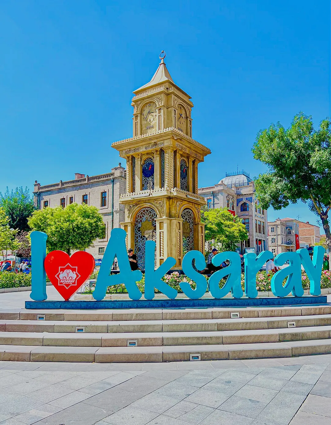
The Aksaray Clock Tower is a popular symbol of Aksaray located in the main square
Photo by Ingeborg Simon
Destinations
Home›Destinations›Aksaray
AsiaTurkeyAksaray

Aksaray

Aksaray, Turkey · Asia

About Aksaray

Aksaray is worth a stop: 15 minutes from Hırkatolu, 28km from Ihlara Valley.

Aksaray is in Turkey, with about 330,000 people. You drive on the right here. The nearest town is Hırkatolu, about 9 km away.

Aksaray (pronounced [ˈaksaɾaj]) is a city in the Central Anatolia region of Turkey. It is the seat of Aksaray Province and Aksaray District. Its population is 247,147 (2021). In 2021 the province had an estimated population of 429,069 distributed over about 7,659 km2 (2,957 mi2). The average elevation is 980 m (3,215

Read more ft), with the highest point being Mt. Hasan (Turkish: Hasan Dağı) at 3,268 m (10,722 ft). The city of Aksaray has a long history and was an important stopover point on the Silk Road that transited Anatolia for centuries. It is a mid-sized city with the Melendiz river running through it and several monuments dating back to the pre-Ottoman era as well as some impressive examples of government buildings from the early Turkish Republic that are gathered around the main square. The nearest airport is Kapadokya Nevşehir Airport (NAV) which is 62.1 km away from the city.

Read more on Wikipedia

Where to Stay in Aksaray

Compare prices across Booking.com, Airbnb, Expedia, and more. Select your dates to see availability.

Filter presets

Pick your must-haves once: provider links open pre-filtered. Each filter lists which sites it applies to.

Booking.comExpediaTripAdvisorHotels.comAgodaAirbnb

Compare before you book!

Prices can vary significantly between platforms. We recommend checking at least 2-3 sites to find the best deal for your stay in Aksaray.

Explore the Area

Discover famous landmarks, scenic roads, and more near Aksaray.

Loading map...
Open in Google Maps

Frequently Asked Questions

What is there to see near Aksaray?

Within an hour or so of Aksaray: Selime Monastery (22 km), Ihlara Valley (28 km).

Where is Aksaray?

Aksaray is in Aksaray, Turkey, about 9 km from Hırkatolu.

Road trip

Drive to Aksaray

Add it as a stop and the planner works out the driving, the nights and what's worth seeing on the way.

Start planning

What's nearby?

Swipe through places to go

Places within a drive of Aksaray. Keep the ones you like and add them to your trip.

Explore now

Quick Information

Population
327,575
Continent
Asia
Country
Turkey
Region
Aksaray
Timezone
Europe/Istanbul
Coordinates
38.3725, 34.0254

Emergency & Services

Essential numbers in Turkey

Police
155
Ambulance
112
Fire
110
All emergencies
112
Driving side
right
Full driving guide for Turkey

Tags

AsiaTurkeyAksarayCity

Worth the detour from Aksaray

2 notable places within an hour's drive.

ancient ruins

Selime Monastery

The largest rock-cut religious complex in Cappadocia, a whole cathedral, kitchen and stable carved into a cone-shaped bluff at the north end of Ihlara Valley. Steep scrambles inside lead out onto ledges over the valley.

22 km · about 25 min drive

natural wonder

Ihlara Valley

A 15km canyon up to 150m deep cut by the Melendiz River through Cappadocian tuff, with around 50 rock-hewn Byzantine churches in its walls, including the Snake Church and its scenes of Hell. Shaded and green, unlike the rest of Cappadocia.

28 km · about 30 min drive

Driving roads near Aksaray

  • 76 kmCappadocia Hot Air Balloon ViewpointThe world-famous sunrise balloon experience over Cappadocia's surreal landscape of fairy chimneys, valleys, and rock-cut settlements.

Nearby Destinations

Other places to explore near Aksaray.

Derinkuyu

🇹🇷 Turkey

62 km awayPop. 12,408

Nevşehir

🇹🇷 Turkey

66 km awayPop. 75,527

Göreme

🇹🇷 Turkey

76 km away

Plan a trip around Aksaray

Asia road trip planner

Your trip starts here

Plan a road trip from Aksaray.

Pick the days, drop in the stops, and share it with whoever's coming.

Start planning
PYRT

The ultimate road trip planning platform. Discover 150,000+ destinations worldwide, plan scenic routes, and create unforgettable adventures.

Inspiration

  • Discover Trips
  • Travel Guides
  • Community

The Product

  • Calendar Planner
  • Integrations
  • How It Works
  • Collaboration Mode
  • Get the App
  • Merchandise: PYRT Supply Co.
  • Become a Creator
  • Trip Marketplace

Plan Your Trip

  • Road Trip Planner
  • Famous Routes
  • Drive Times & Distances
  • Planners by Country
  • Best Road Trip Planner App
  • Discover Road Trips
  • Events
  • Travel Guides
  • How It Works
  • My Trips
  • Community Groups

Company

  • Terms of Service
  • Privacy Policy
  • About PYRT
  • Support
  • Contact Us
  • Sign In
  • Create Account

© 2026 Plan Your Road Trips. All rights reserved.

•[email protected]
Data sources:GeoNames (CC BY 4.0)•Wikimedia Commons (CC BY-SA)•Mapbox•Photography: George Lawrence