PYRTPlan Your Road Trips
Create TripCommunityMerchandise
PYRTPlan Your Road Trips
Create TripCommunityMerchandise
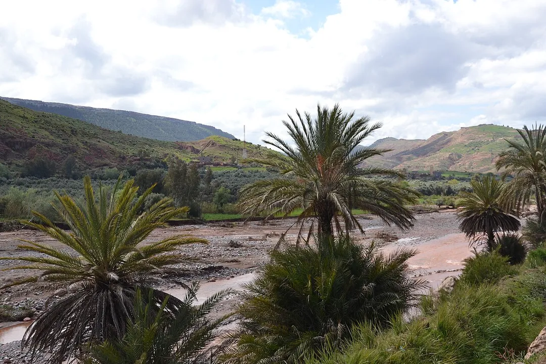
Sunny green space
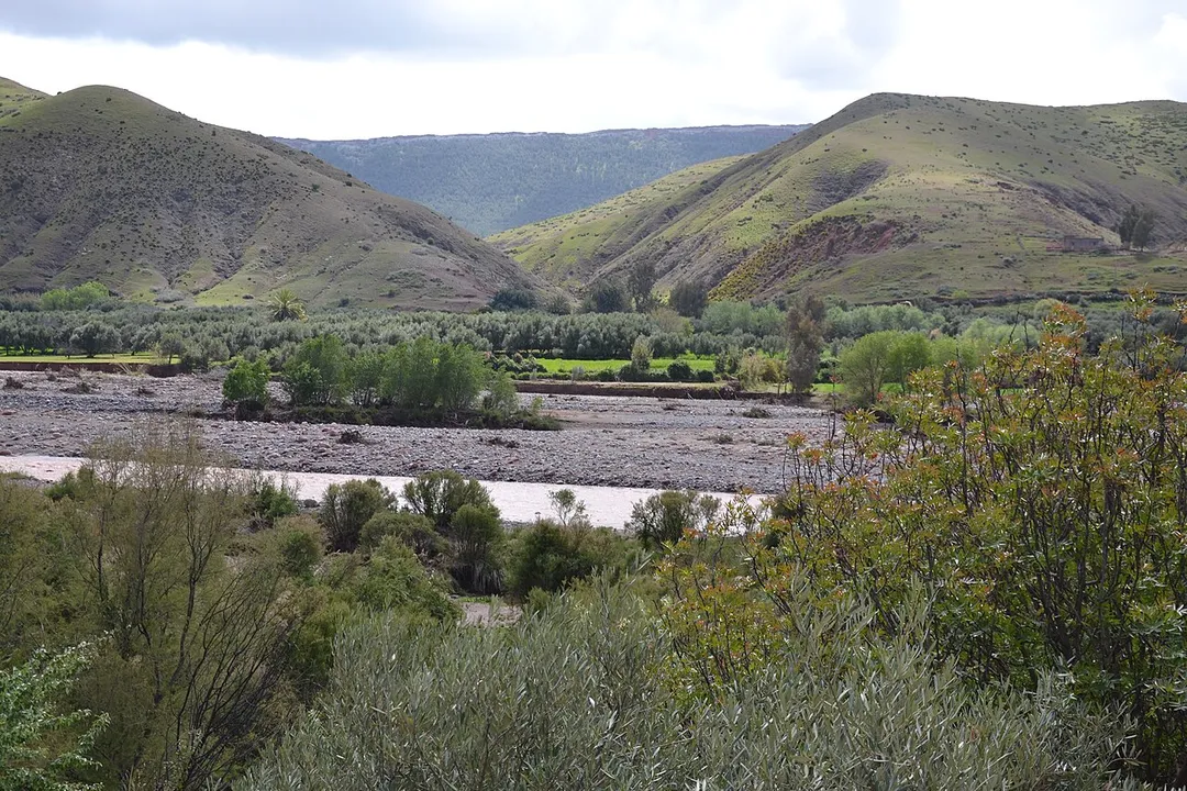
The Nature of Ait Ourir , the lake , the sun , green space
Green Space
Photo by Hamzasaissihassani
Destinations
Home›Destinations›Ait Ourir
AfricaMoroccoMarrakesh-Safi

Ait Ourir

Marrakesh-Safi, Morocco · Africa

About Ait Ourir

Ait Ourir sits on the route: 25 minutes from Tidili Mesfioua, 31km from Circuit International Automobile Moulay El Hassan.

Ait Ourir is in Marrakesh-Safi, Morocco, with about 43,000 people. You drive on the right here. The nearest town is Tidili Mesfioua, about 12 km away.

Ait Ourir is a city and municipality in Al Haouz Province, Marrakesh-Safi, Morocco. At the time of the 2024 Moroccan census, the commune had a total population of 56,954 people living in 13,312 households. The city lies on the northern bank of the Zat river, 29.8 kilometres (18.5 mi) by road to the northwest of

Read more Tighedouine and 33.3 kilometres (20.7 mi) east of the city centre of Marrakesh. It is the biggest city of Al Haouz Province.

Read more on Wikipedia

Where to Stay in Ait Ourir

Compare prices across Booking.com, Airbnb, Expedia, and more. Select your dates to see availability.

Filter presets

Pick your must-haves once: provider links open pre-filtered. Each filter lists which sites it applies to.

Booking.comExpediaTripAdvisorHotels.comAgodaAirbnb

Compare before you book!

Prices can vary significantly between platforms. We recommend checking at least 2-3 sites to find the best deal for your stay in Ait Ourir.

Explore the Area

Discover famous landmarks, scenic roads, and more near Ait Ourir.

Loading map...
Open in Google Maps

Frequently Asked Questions

What is there to see near Ait Ourir?

Within an hour or so of Ait Ourir: Circuit International Automobile Moulay El Hassan (31 km), Ourika Valley (35 km), Tizi n'Tichka (41 km), Tizi n'Tichka Pass (41 km).

Are there any good drives near Ait Ourir?

The nearest famous roads are Circuit International Automobile Moulay El Hassan, Tizi n'Tichka and Tizi n'Tichka Pass.

Where is Ait Ourir?

Ait Ourir is in Marrakesh-Safi, Morocco, about 12 km from Tidili Mesfioua.

Road trip

Drive to Ait Ourir

Add it as a stop and the planner works out the driving, the nights and what's worth seeing on the way.

Start planning

What's nearby?

Swipe through places to go

Places within a drive of Ait Ourir. Keep the ones you like and add them to your trip.

Explore now

Quick Information

Population
42,705
Continent
Africa
Country
Morocco
Region
Marrakesh-Safi
Timezone
Africa/Casablanca
Coordinates
31.5652, -7.6616

Emergency & Services

Essential numbers in Morocco

Police
19
Ambulance
15
Fire
15
Driving side
right

Royal Gendarmerie (outside cities): 177.

Full driving guide for Morocco

Tags

AfricaMoroccoMarrakesh-SafiTown

Worth the detour from Ait Ourir

6 notable places within an hour's drive.

famous road

Circuit International Automobile Moulay El Hassan

A street circuit in Marrakech running alongside the Menara gardens, host of the World Touring Car Championship. Palm-lined public boulevards outside race weekends.

31 km · about 35 min drive

scenic viewpoint

Ourika Valley

A green river valley south of Marrakesh with roadside cafés and a road running to the Setti Fatma waterfalls.

35 km · about 40 min drive

mountain pass

Tizi n'Tichka

Morocco's highest road pass at 2260m on the route from Marrakech to Ouarzazate, winding through the High Atlas Mountains with dramatic North African landscapes.

41 km · about 45 min drive

famous road

Tizi n'Tichka Pass

The 2,260m High Atlas pass on the Marrakesh-Ouarzazate road, recently rebuilt and endlessly serpentine.

41 km · about 45 min drive

mountain pass

Oukaïmeden

A High Atlas ski station at 2600m, about 75km from Marrakesh by a paved mountain road, with prehistoric rock carvings.

45 km · about 50 min drive

castle

Kasbah Telouet

A decaying Glaoui palace off the Tizi n'Tichka road, with ornate painted and tiled reception rooms still intact.

51 km · about 60 min drive

Driving roads near Ait Ourir

  • 31 kmCircuit International Automobile Moulay El HassanA street circuit in Marrakech running alongside the Menara gardens, host of the World Touring Car Championship. Palm-lined public boulevards outside race weekends.
  • 35 kmOurika ValleyA green river valley south of Marrakesh with roadside cafés and a road running to the Setti Fatma waterfalls.
  • 41 kmTizi n'TichkaMorocco's highest road pass at 2260m on the route from Marrakech to Ouarzazate, winding through the High Atlas Mountains with dramatic North African landscapes.
  • 41 kmTizi n'Tichka PassThe 2,260m High Atlas pass on the Marrakesh-Ouarzazate road, recently rebuilt and endlessly serpentine.
  • 45 kmOukaïmedenA High Atlas ski station at 2600m, about 75km from Marrakesh by a paved mountain road, with prehistoric rock carvings.

Nearby Destinations

Other places to explore near Ait Ourir.

Aghmat

🇲🇦 Morocco

21 km awayPop. 1,319

Marrakesh

🇲🇦 Morocco

33 km awayPop. 995,871

Tahannout

🇲🇦 Morocco

36 km awayPop. 13,215

Setti Fatma

🇲🇦 Morocco

38 km awayPop. 22,283

Oukaïmedene

🇲🇦 Morocco

44 km awayPop. 4,440

Asni

🇲🇦 Morocco

46 km awayPop. 18,674

Tamansourt

🇲🇦 Morocco

47 km awayPop. 27,383

Amizmiz

🇲🇦 Morocco

67 km awayPop. 15,685

Your trip starts here

Plan a road trip from Ait Ourir.

Pick the days, drop in the stops, and share it with whoever's coming.

Start planning
PYRT

The ultimate road trip planning platform. Discover 150,000+ destinations worldwide, plan scenic routes, and create unforgettable adventures.

Inspiration

  • Discover Trips
  • Travel Guides
  • Community

The Product

  • Calendar Planner
  • Integrations
  • How It Works
  • Collaboration Mode
  • Get the App
  • Merchandise: PYRT Supply Co.
  • Become a Creator
  • Trip Marketplace

Plan Your Trip

  • Road Trip Planner
  • Famous Routes
  • Drive Times & Distances
  • Planners by Country
  • Best Road Trip Planner App
  • Discover Road Trips
  • Events
  • Travel Guides
  • How It Works
  • My Trips
  • Community Groups

Company

  • Terms of Service
  • Privacy Policy
  • About PYRT
  • Support
  • Contact Us
  • Sign In
  • Create Account

© 2026 Plan Your Road Trips. All rights reserved.

•[email protected]
Data sources:GeoNames (CC BY 4.0)•Wikimedia Commons (CC BY-SA)•Mapbox•Photography: George Lawrence