
PYRTPlan Your Road Trips
Create TripCommunityMerchandise
PYRTPlan Your Road Trips
Create TripCommunityMerchandise
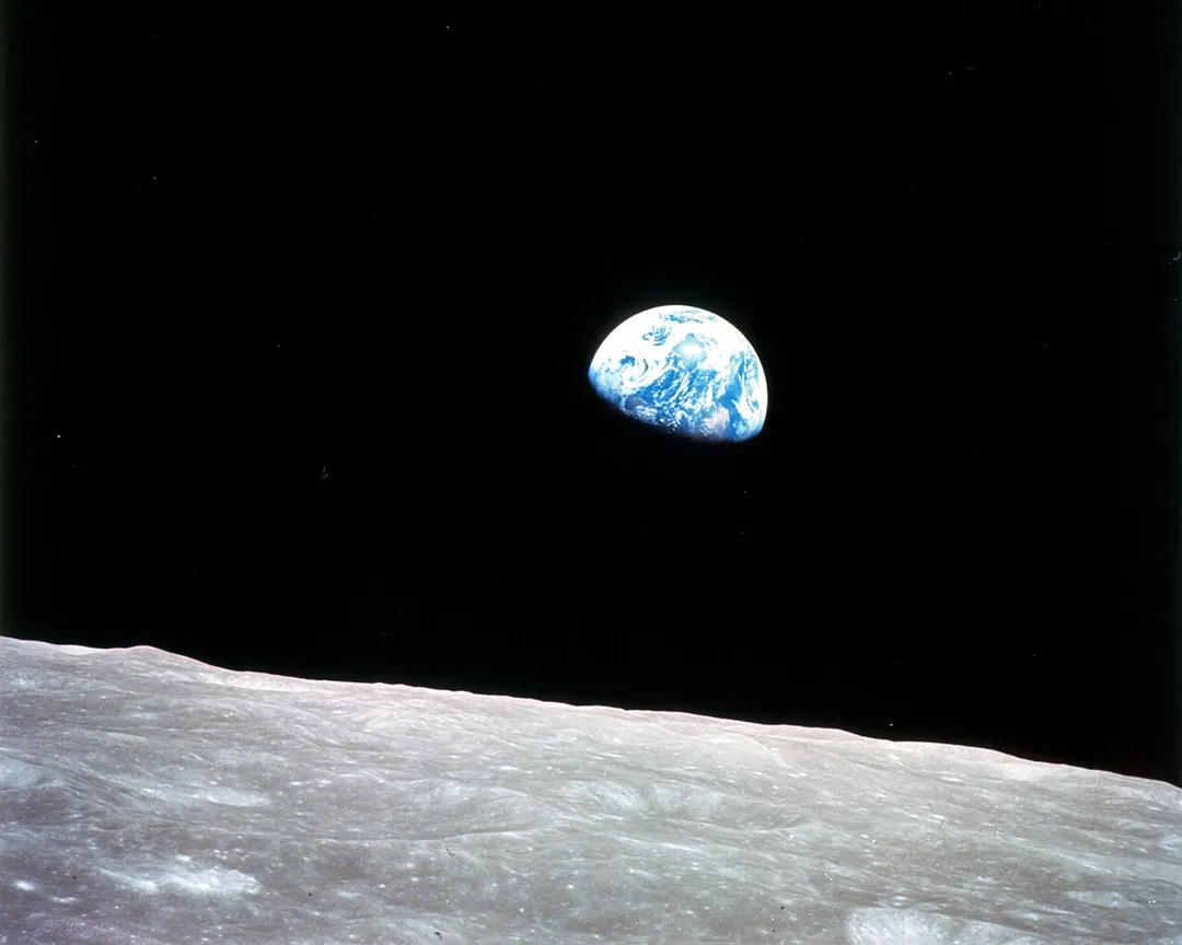
This view of the rising Earth greeted the Apollo 8 astronauts as they came from behind the Moon after the fourth nearside orbit. Earth is about five degrees above the horizon in the photo. The unnamed surface features in the foreground are near the eastern limb of the Moon as viewed from Earth. The lunar horizon is approximately 780 kilometers from the spacecraft. Width of the photographed area at the horizon is about 175 kilometers. On the Earth 240,000 miles away, the sunset terminator bisects Africa.
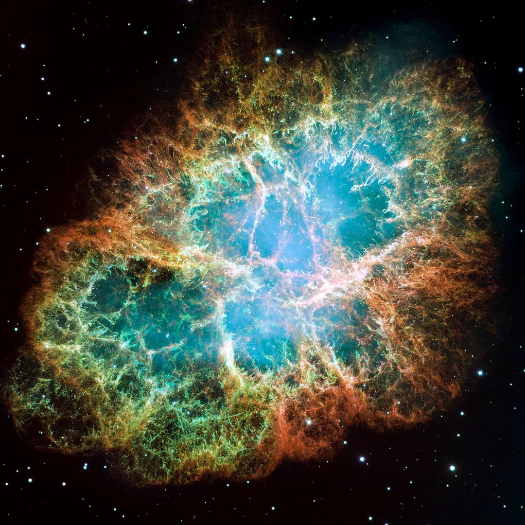
This is a mosaic image, one of the largest ever taken by NASA's Hubble Space Telescope, of the Crab Nebula, a six-light-year-wide expanding remnant of a star's supernova explosion. Japanese and Chinese astronomers recorded this violent event in 1054 CE.

The orange filaments are the tattered remains of the star and consist mostly of hydrogen. The rapidly spinning neutron star embedded in the center of the nebula is the dynamo powering the nebula's eerie interior bluish glow. The blue light comes from electrons whirling at nearly the speed of light around magnetic field lines from the neutron star. The neutron star, like a lighthouse, ejects twin beams of radiation that appear to pulse 30 times a second due to the neutron star's rotation. A neutron star is the crushed ultra-dense core of the exploded star.

The Crab Nebula derived its name from its appearance in a drawing made by Irish astronomer Lord Rosse in 1844, using a 36-inch telescope. When viewed by Hubble, as well as by large ground-based telescopes such as the European Southern Observatory's Very Large Telescope, the Crab Nebula takes on a more detailed appearance that yields clues into the spectacular demise of a star, 6,500 light-years away.

The newly composed image was assembled from 24 individual Wide Field and Planetary Camera 2 exposures taken in October 1999, January 2000, and December 2000. The colors in the image indicate the different elements that were expelled during the explosion. Blue in the filaments in the outer part of the nebula represents neutral oxygen, green is singly-ionized sulfur, and red indicates doubly-ionized oxygen.
Guatemala City
Photo by Apollo 8 crewmember Bill Anders
Destinations
Home›Destinations›Airali
EuropeItalyPiedmont

Airali

Piedmont, Italy · Europe

About Airali

Airali is worth a stop: 5 minutes from Bibiana, 41km from Col d'Izoard.

Airali is in Piedmont, Italy, with about 5,600 people. You drive on the right here. The nearest town is Bibiana, about 4 km away.

Where to Stay in Airali

Compare prices across Booking.com, Airbnb, Expedia, and more. Select your dates to see availability.

Filter presets

Pick your must-haves once: provider links open pre-filtered. Each filter lists which sites it applies to.

Booking.comExpediaTripAdvisorHotels.comAgodaAirbnb

Compare before you book!

Prices can vary significantly between platforms. We recommend checking at least 2-3 sites to find the best deal for your stay in Airali.

Explore the Area

Discover famous landmarks, scenic roads, and more near Airali.

Loading map...
Open in Google Maps

Frequently Asked Questions

What is there to see near Airali?

Within an hour or so of Airali: Col d'Agnel (26 km), Colle dell'Agnello (26 km), Sacra di San Michele (32 km), Colle delle Finestre (32 km).

Are there any good drives near Airali?

The nearest famous roads are Col d'Agnel, Colle dell'Agnello and Colle delle Finestre.

Where is Airali?

Airali is in Piedmont, Italy, about 4 km from Bibiana.

Road trip

Drive to Airali

Add it as a stop and the planner works out the driving, the nights and what's worth seeing on the way.

Start planning

What's nearby?

Swipe through places to go

Places within a drive of Airali. Keep the ones you like and add them to your trip.

Explore now

Quick Information

Population
5,619
Continent
Europe
Country
Italy
Region
Piedmont
Timezone
Europe/Rome
Coordinates
44.8167, 7.2516

Emergency & Services

Essential numbers in Italy

Police
113
Ambulance
118
Fire
115
All emergencies
112
Driving side
right

ACI roadside assistance: 803 116. ZTL (limited traffic zones) in city centres are camera-enforced.

Full driving guide for Italy

Tags

EuropeItalyPiedmontTown

Worth the detour from Airali

8 notable places within an hour's drive.

mountain pass

Col d'Agnel

One of the highest paved border crossings in the Alps at 2744m between France and Italy, remote and quiet with an authentic high-mountain atmosphere.

26 km · about 30 min drive

mountain pass

Colle dell'Agnello

At 2,744 m one of Europe's highest paved passes, a remote, exhilarating drive on the French border above Pontechianale.

26 km · about 30 min drive

landmark

Sacra di San Michele

A dramatic Romanesque-Gothic abbey perched atop a rocky peak in the Susa Valley, said to have inspired The Name of the Rose.

32 km · about 35 min drive

mountain pass

Colle delle Finestre

A legendary 2,178 m Piedmont climb from the Susa Valley: 33 paved hairpins followed by a historic unpaved military road to the summit, made famous by dramatic Giro d'Italia stages.

32 km · about 35 min drive

racetrack

Lingotto Rooftop Test Track

The legendary banked test track on the roof of Fiat's 1923 Lingotto factory in Turin, star of The Italian Job. Now 'La Pista 500', a rooftop garden you can stroll beside the Casa 500 Fiat museum.

40 km · about 45 min drive

film location

Lingotto rooftop test track, Turin (The Italian Job)

The banked rooftop track of the former Fiat factory features in the 1969 Italian Job Mini chase; it is open to walk today.

40 km · about 45 min drive

famous road

Col d'Izoard

A famous Tour de France climb at 2,360 meters passing through the otherworldly rock formations of the Casse Déserte.

41 km · about 45 min drive

museum

Museo Nazionale dell'Automobile (MAUTO)

Italy's national automobile museum in Turin with over 200 cars tracing the entire history of the automobile.

41 km · about 45 min drive

Driving roads near Airali

9 named roads, passes and coastal drives within 60km.

  • 26 kmCol d'AgnelOne of the highest paved border crossings in the Alps at 2744m between France and Italy, remote and quiet with an authentic high-mountain atmosphere.
  • 26 kmColle dell'AgnelloAt 2,744 m one of Europe's highest paved passes, a remote, exhilarating drive on the French border above Pontechianale.
  • 32 kmColle delle FinestreA legendary 2,178 m Piedmont climb from the Susa Valley: 33 paved hairpins followed by a historic unpaved military road to the summit, made famous by dramatic Giro d'Italia stages.
  • 41 kmCol d'IzoardA famous Tour de France climb at 2,360 meters passing through the otherworldly rock formations of the Casse Déserte.
  • 41 kmCol d'Izoard and the Casse DeserteA 2,360m Alpine pass whose southern side crosses the Casse Deserte, a shattered lunar landscape of rock spires.
  • 48 kmColle Fauniera (Colle dei Morti)A remote, rough 2,481m pass in the Maritime Alps with almost no traffic and a Pantani memorial at the summit.

Driving in Italy

Drives on
the right
Petrol
~€1.82/litre
Motorway tolls
~€8.50/100km

When to drive here

April to October

Nearby Destinations

Other places to explore near Airali.

Pinerolo

🇮🇹 Italy

10 km awayPop. 30,866

Ostana

🇮🇹 Italy

15 km awayPop. 79

Oncino

🇮🇹 Italy

16 km awayPop. 25

Plan a trip around Airali

Italy road trip planner

Your trip starts here

Plan a road trip from Airali.

Pick the days, drop in the stops, and share it with whoever's coming.

Start planning
PYRT

The ultimate road trip planning platform. Discover 150,000+ destinations worldwide, plan scenic routes, and create unforgettable adventures.

Inspiration

  • Discover Trips
  • Travel Guides
  • Community

The Product

  • Calendar Planner
  • Integrations
  • How It Works
  • Collaboration Mode
  • Get the App
  • Merchandise: PYRT Supply Co.
  • Become a Creator
  • Trip Marketplace

Plan Your Trip

  • Road Trip Planner
  • Famous Routes
  • Drive Times & Distances
  • Planners by Country
  • Best Road Trip Planner App
  • Discover Road Trips
  • Events
  • Travel Guides
  • How It Works
  • My Trips
  • Community Groups

Company

  • Terms of Service
  • Privacy Policy
  • About PYRT
  • Support
  • Contact Us
  • Sign In
  • Create Account

© 2026 Plan Your Road Trips. All rights reserved.

•[email protected]
Data sources:GeoNames (CC BY 4.0)•Wikimedia Commons (CC BY-SA)•Mapbox•Photography: George Lawrence