PYRTPlan Your Road Trips
Create TripCommunityMerchandise
PYRTPlan Your Road Trips
Create TripCommunityMerchandise
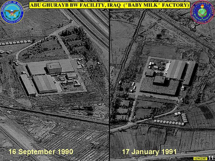
In the fall of 2002, at the same time that the U.S. brought its concerns to the U.N. Security Council and argued that action needed to be taken to completely eliminate Iraqi holdings of, and its ability to produce, WMD, the CIA released an unclassified version of its new National Intelligence Estimate on Iraqi WMD, which contained several satellite images of Iraqi facilities of concern. Images were also released at the time President Bush gave an October 7 speech on the Iraqi issue and the following day as part of a Defense Department briefing on Iraqi denial and deception.
The "Abu Ghurayb BW Facility," which Iraq claimed was a baby milk factory. U.S. intelligence had classified it as biological warfare facility since 1988, and Image 9 is one of several (including some from commercial satellites) presented in the DoD briefing in October 2002 on Iraqi denial and deception.

"Fallujah/Habbaniyah," https://www.globalsecurity.org; Central Intelligence Agency, Iraq's Weapons of Mass Destruction Programs, p.11; DoD, Iraqi Denial and Deception for Weapons of Mass Destruction & Ballistic Missile Programs, slide 14; "Abu Ghurabyb, Project 600," https://www.fas.org.
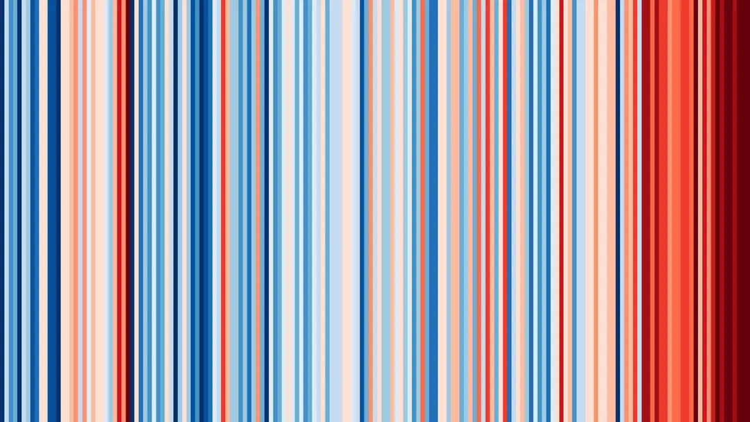
Show Your Stripes change in temperature graphic for Iraq, Abū Ghurayb. These warming stripe graphics are visual representations of the change in temperature as measured in each country, region or city over the past 100+ years. Each stripe or bar represents the temperature in that country, region or city averaged over a year. Data for this graphic is from Berkeley Earth (BK).
Show Your Stripes change in temperature graphic for Abū Ghurayb, Iraq with labels. These warming stripe graphics are visual representations of the change in temperature as measured in each country, region or city over the past 100+ years. Each stripe or bar represents the temperature in that country, region or city averaged over a year. Data for this graphic is from Berkeley Earth (BK).
Photo by DoD
Destinations
Home›Destinations›Abū Ghurayb
AsiaIraqBaghdad

Abū Ghurayb

Baghdad, Iraq · Asia

About Abū Ghurayb

Abū Ghurayb sits on the route: 25 minutes from Baghdad.

Abū Ghurayb is in Baghdad, Iraq, with about 900,000 people. The nearest town is Baghdad, about 20 km away.

Where to Stay in Abū Ghurayb

Compare prices across Booking.com, Airbnb, Expedia, and more. Select your dates to see availability.

Filter presets

Pick your must-haves once: provider links open pre-filtered. Each filter lists which sites it applies to.

Booking.comExpediaTripAdvisorHotels.comAgodaAirbnb

Compare before you book!

Prices can vary significantly between platforms. We recommend checking at least 2-3 sites to find the best deal for your stay in Abū Ghurayb.

Explore the Area

Discover famous landmarks, scenic roads, and more near Abū Ghurayb.

Loading map...
Open in Google Maps

Frequently Asked Questions

Where is Abū Ghurayb?

Abū Ghurayb is in Baghdad, Iraq, about 20 km from Baghdad.

Road trip

Drive to Abū Ghurayb

Add it as a stop and the planner works out the driving, the nights and what's worth seeing on the way.

Start planning

What's nearby?

Swipe through places to go

Places within a drive of Abū Ghurayb. Keep the ones you like and add them to your trip.

Explore now

Quick Information

Population
900,000
Continent
Asia
Country
Iraq
Region
Baghdad
Timezone
Asia/Baghdad
Coordinates
33.3056, 44.1848

Tags

AsiaIraqBaghdadCity

Nearby Destinations

Other places to explore near Abū Ghurayb.

Baghdad

🇮🇶 Iraq

20 km awayPop. 7,216,000

Sadr City

🇮🇶 Iraq

27 km awayPop. 1,211,849

Al Fallūjah

🇮🇶 Iraq

37 km awayPop. 190,159

Al-Musayab

🇮🇶 Iraq

59 km awayPop. 101,873

Baqubah

🇮🇶 Iraq

63 km awayPop. 152,550

Khāliş

🇮🇶 Iraq

65 km awayPop. 70,046

Saddat al Hindīyah

🇮🇶 Iraq

66 km awayPop. 35,720

Karbala

🇮🇶 Iraq

78 km awayPop. 1,218,732

Plan a trip around Abū Ghurayb

Asia road trip planner

Your trip starts here

Plan a road trip from Abū Ghurayb.

Pick the days, drop in the stops, and share it with whoever's coming.

Start planning
PYRT

The ultimate road trip planning platform. Discover 150,000+ destinations worldwide, plan scenic routes, and create unforgettable adventures.

Inspiration

  • Discover Trips
  • Travel Guides
  • Community

The Product

  • Calendar Planner
  • Integrations
  • How It Works
  • Collaboration Mode
  • Get the App
  • Merchandise: PYRT Supply Co.
  • Become a Creator
  • Trip Marketplace

Plan Your Trip

  • Road Trip Planner
  • Famous Routes
  • Drive Times & Distances
  • Planners by Country
  • Best Road Trip Planner App
  • Discover Road Trips
  • Events
  • Travel Guides
  • How It Works
  • My Trips
  • Community Groups

Company

  • Terms of Service
  • Privacy Policy
  • About PYRT
  • Support
  • Contact Us
  • Sign In
  • Create Account

© 2026 Plan Your Road Trips. All rights reserved.

•[email protected]
Data sources:GeoNames (CC BY 4.0)•Wikimedia Commons (CC BY-SA)•Mapbox•Photography: George Lawrence